
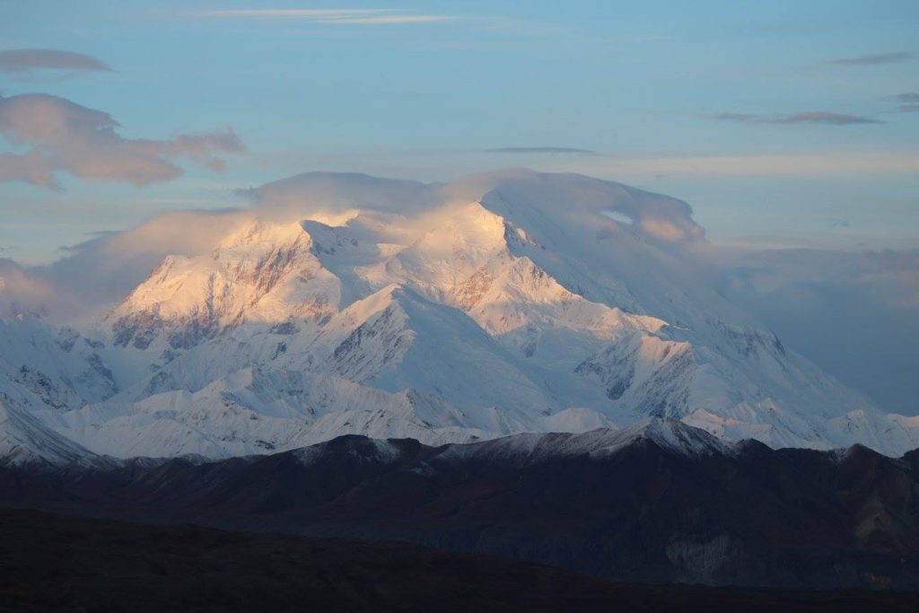
Article Summary: Denali National Park Hikes, Denali National Park Trails, Hiking in Denali, Best Hikes in Denali
Denali is known for being one of the largest national parks in the country. It’s also known for its vast wilderness.
Because of its wild nature, there are only 35 miles of hiking trails in Denali National Park. Theoretically, you could do them all in one visit! I’ve had the pleasure of hiking each trail multiple times.
Here’s a complete list of Denali National Park hikes, ranked from best to… still really great. There’s no such thing as a bad trail in Denali! Keep reading for the best hikes in Denali National Park.
This post may contain affiliate links. If you make a purchase, I may earn a small commission at no additional cost to you. For more information, view my privacy policy.
Table of Contents
Logistics of Visiting Denali National Park

How to Get to Denali National Park
You can reach Denali by car, bus, or train. Fairbanks and Anchorage are the two largest cities in Alaska and the best transportation hubs.
From Denali, Fairbanks is about 2 hours while Anchorage is about 5 hours. Each city has its own international airport, rental car facilities, bus stations, and a railroad depot.
Once you have your mode of transportation secured, there is only one road into the park.
Private vehicles may only travel along the first 15 miles of Denali’s Park Road. This is the paved section. Beyond this point (Savage River), you’ll need to travel on one of the park buses. You can purchase tickets here or once you arrive at the Denali Bus Depot.
IMPORTANT: As of August 2021, Denali Park Road is partially closed due to a massive landslide. It’s expected to reopen in 2026. Learn more here.
How Much Does Denali National Park Cost?
There is a fee to enter Denali National Park. It costs $10 per person. This fee is valid for 7 days. If you reserve a campsite or purchase a bus ticket, this fee is included.
In order to save money, I would recommend purchasing a national parks pass. These cost $80 and are valid for a full calendar year (from the date of purchase) at all public lands in the United States. After you visit 3 national parks, it’ll have paid for itself. It also makes a great gift for national park enthusiasts! Learn more about park entry fees.
Read More About Denali National Park
About Hiking in Denali National Park

Be prepared for wildlife encounters. Moose and bears frequent the trails in Denali National Park. Always carry bear spray and be sure to read about bear safety before you go.
In summary, remember to never run away from bears or any other predators. If you see a moose, especially one with calves, you should run to safety. The same goes for other non-predatory species.
Off-trail hiking in Denali is encouraged. However, if there is a trail you’re following, you should stick to it. Don’t venture off-trail if there is a trail you should be on.
Otherwise, if you’re in the wilderness and there are no trails to be found, you can explore as you wish. Try to lessen your impact by avoiding hiking in a single-file line.
What to Pack for Hiking Trails in Denali National Park
For more recommendations, read about my favorite outdoor gear and the best daypacks for women. For your trip to Alaska, here’s what to wear.

Denali National Park Phone Case

Fodor’s Guide to the 63 National Parks

Denali National Park Puffy Blanket

Women’s National Parks Checklist T-Shirt

Women’s National Parks Checklist T-Shirt

Map of National Parks T-Shirt

Denali National Park Sticker

Denali National Park Patch

63 National Parks Water Bottle

Denali National Park Sticker

Denali National Park Candle

Denali National Park Cross Stitch Kit

Denali National Park Sticker

Denali National Park Vintage Sweatshirt

Denali National Park Alaska: Guide to Hiking, Photography and Camping

Denali National Park Map
The 10 Hiking Essentials
Every hiker should always carry the ten essentials with them. These include:
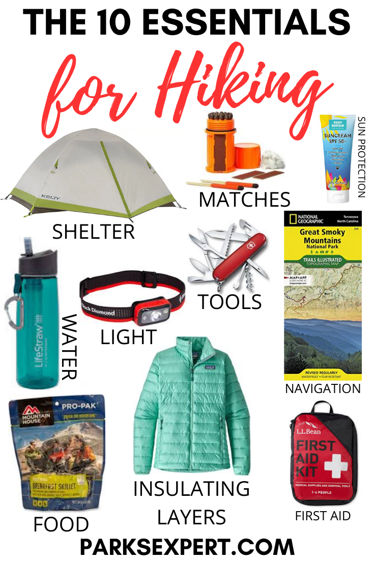
- Navigation systems: map, compass, and/or GPS
- Sun protection: sunscreen and/or ballcap
- Insulating layers: synthetic or down jacket, rain jacket, hat, gloves, and leggings
- Illumination (flashlight or headlamp)
- First-aid kit
- Something to light a fire: lighter, waterproof matches, and/or fire starter
- Repair kits and tools: pocket knife, duct tape, screwdriver, and/or scissors
- Emergency shelter: tent, bivy, tarp, and/or space blanket
- Nutrition: food for both meals and snacks
- Hydration: water bottle, water treatment (LifeStraw or SteriPen), and water
Frequently Asked Questions About Denali Trails
Which trails have views of Denali?
Mount Healy Overlook, Mountain Vista, Savage Alpine, Thorofare Ridge, Gorge Creek, Tundra Loop, and McKinley Bar.
Views of Denali are completely dependent on the weather during your trip and are not guaranteed. Remember, only 30% of visitors ever catch a glimpse of the mountain.
Which trails are best for wildlife?
This changes daily as the wildlife do what they’d like to do. There is no correct answer.
I only have a few hours. Which trail should I do?
Savage River Loop, Horseshoe Lake, or Rock Creek.
Best Hikes in Denali National Park
1. Savage Alpine Trail
The Savage Alpine Trail is my personal favorite, and easily one of the best trails in Denali National Park.
On a clear day, you have sweeping views of the Alaska Range (including Denali itself) once you’re high enough on the trail. There’s a lot of elevation gain, but it’s worth every step.
Even if it’s not a crystal clear day, you’ll experience two types of habitat: boreal forest and tundra. There’s even some rock scrambling possible if you venture away from the trail.
Occasionally, you’ll see wildlife along the trail including Arctic ground squirrels and Dall sheep. Bears also frequent the area, so make sure you’re prepared by studying my post on bear safety.
I recommend beginning from the Savage River area to get most of your strenuous climbing out of the way first. This is also best if, like me, you dislike very steep downhill hikes due to the impact on your knees.
Park your vehicle at Mountain Vista around the time the free shuttle arrives, then take that to Savage River. That way you are hiking back to your car and don’t need to worry about bus schedules as you hike. Mountain Vista usually has more parking available as well.

Difficulty: Strenuous
Distance: 4 mi / 6.4 km one-way
Elevation Gain: 1,500 ft / 457 m
Estimated Time: 2-3 hours
Type of Trail: Out and back (or utilize the bus system)
Map: All Trails map
Trailhead Location: East Savage River parking area or Mountain Vista parking area
Note: This trail is NOT a loop and you will end 2 miles from where you started. Plan accordingly by using Denali’s free Savage River Shuttle.
2. Thorofare Ridge Trail
This is quite possibly the most difficult trail, but it’s also one of the best hikes in Denali National Park. It requires a steep climb for the duration of your hike, entirely uphill one way and downhill the other.
However, on a clear day, it also offers the most spectacular view of Denali itself. Once the maintained trail ends, you can also continue hiking to explore the ridgeline further.
Park Rangers lead hikes on the Thorofare Ridge Trail daily, usually in the afternoon. Inquire at the Eielson Visitor Center.
Due to the road closure, this trail is currently inaccessible.

Difficulty: Strenuous
Distance: 1 mi / 1.6 km one-way
Elevation Gain: 1,000 ft / 305 m
Estimated Time: 1-2 hours
Type of Trail: Out and back
Map: All Trails map
Trailhead Location: Eielson Visitor Center
3. Horseshoe Lake Trail
Horseshoe Lake Trail is one of the best trails in Denali National Park. You get a wide variety of habitats, have a decent chance of spotting wildlife, and there are great views.
You’ll start by hiking along the railroad bed before descending a steep hill. Then, you’ll make a loop that includes Horseshoe Lake and the Nenana River.
Moose can occasionally be seen in the lake along with beavers and muskrats. Even if you don’t see wildlife, you’ll certainly see evidence of them with squirrel middens, beaver-felled trees, and a large beaver dam along the trail.
On your way back, you’ll have to climb up the same hill you descended at the beginning, which is the only difficult portion of the trail.

Difficulty: Moderate
Distance: 3.2 mi / 5.1 km roundtrip
Elevation Gain: 250 ft / 76 m
Estimated Time: 2 hours
Type of Trail: Loop
Map: All Trails map
Trailhead Location: Denali Visitor Center or Railroad Crossing (beginning at the railroad takes about 1 mile away from the distance)
4. Savage River Loop
Of all of the easy trails in Denali, Savage River is the best. It provides the best scenery and amazing tranquility, which is why it’s also one of the best hikes in Denali National Park overall.
You’ll follow the Savage River through a canyon and cross a footbridge over the river to return to the Park Road. Each parking area at Savage River (east and west) has a trailhead for this loop.
Beyond the footbridge, the trail is unmaintained but does continue if you’re up for an adventure. Bears and moose are occasionally seen here, so use caution. Do not approach, feed, or taunt wildlife.

Difficulty: Easy
Distance: 2 mi / 3.2 km roundtrip
Elevation Gain: Negligible
Estimated Time: 1-2 hours
Type of Trail: Loop
Map: All Trails map
Trailhead Location: Savage River Parking Area (East or West)
5. Triple Lakes Trail
Triple Lakes is the longest trail in Denali National Park.
If you begin at the Denali Visitor Center, you’ll have steep switchbacks to climb. Therefore, I recommend beginning on the southern side. There is a shuttle you can take here from the Denali Visitor Center – you can inquire with park rangers inside for information.
If you do begin on the south end, I would personally rate the trail as only moderately difficult. The most challenging element is the length of the trail and getting back to the start once you’ve finished.
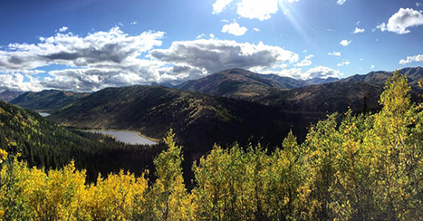
If you’re up for it, the trail provides astounding views and is best in the fall. It’s also a great way to escape the crowds that focus on either end of the trail but rarely hike it in full.
Difficulty: Strenuous
Distance: 9.5 mi / 15.3 km one-way
Elevation Gain: 1,000 ft / 305 m
Estimated Time: 3-5 hours
Type of Trail: Out and back
Trailhead Location: Southern entrance sign near the Nenana River bridge or Denali Visitor Center
6. Mountain Vista Trail
Many people who know Denali National Park well will probably disagree with me on where Mountain Vista appears on this list.
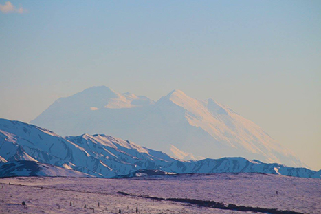
However, I love the Mountain Vista Trail, especially in winter. It provides great views of Denali without too much effort. If you have limited time and you’re hoping to see the mountain, this is one of the best hikes for you.
Furthermore, you can access the Savage River and potentially see small mammals. There are great wildflowers blooming throughout the summer as well.
Lastly, signs along the trail provide information about Savage Camp and the first visitors to the park as tourism began to thrive here. It’s a very interesting history and provides a glimpse into Denali’s continued popularity in Alaska and the United States.
This trail is accessible.
Difficulty: Easy
Distance: 0.6 mi / 1 km roundtrip
Elevation Gain: 50 ft / 15 m
Estimated Time: 30 minutes
Type of Trail: Loop
Map: All Trails map
Trailhead Location: Mountain Vista Parking Area
7. Mount Healy Overlook Trail
Of all the strenuous trails in Denali, Mount Healy is my least favorite. The view from the top is spectacular, but getting up there is quite the challenge.
The real reason, however, that I don’t favor this trail is that the views on the way up aren’t great. You’ll have a great reward once you’ve completed the hike, but along the way, you’ll see a lot of spruce trees.
If it’s a clear day, it’s worth it, but I’d personally still prefer to hike Savage Alpine instead. It’s shorter, the views are great for the entirety of the trail, and there is less elevation gain. Regardless, this is still one of the best Denali National Park hikes.

Difficulty: Strenuous
Distance: 2.7 mi / 4.3 km one-way
Elevation Gain: 1,700 ft / 518 m
Estimated Time: 4-5 hours
Type of Trail: Out and back
Map: All Trails map
Trailhead Location: Denali Visitor Center (start on the Taiga Trail)
8. Rock Creek Trail
One of the best things about Denali’s trail system is the ability to create loops. The Rock Creek, Roadside, Taiga, and Meadowview trails are perfect for this.
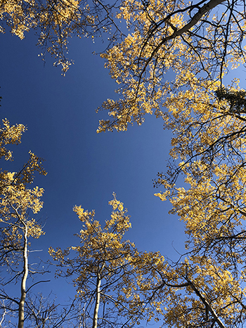
On its own, Rock Creek is still a great trail. When the trees clear, it provides some great views of the surrounding foothills. Walk the trail in the fall for even more scenic vistas.
If you’re planning on attending the Sled Dog Demonstration at the Kennels, walking this trail is a great way to avoid taking the free shuttle. You can walk between the Kennels and the Denali Visitor Center along Rock Creek Trail for great views and a peaceful walk.
Expect to climb at either end of the trail, have easy walking throughout the middle, then descend at the very end no matter which way you choose.
Difficulty: Moderate
Distance: 2.4 mi / 3.8 km one-way
Elevation Gain: 400 ft / 122 m
Estimated Time: 1-2 hours
Type of Trail: Out and back
Map: All Trails map
Trailhead Location: Denali Visitor Center or Park Headquarters/Kennels
9. McKinley Bar Trail
It took me years to hike this trail. It seemed that every time I tried, something got in the way (once it was a huge snowstorm at the beginning of June!). Finally, I hiked this trail for the first time in 2019, and it’s one of the best trails in Denali National Park.
It’s a nice trail that goes through the spruce forest and boggy terrain leading to the McKinley River. Once there, you can walk along the side of the river. Here, you can see great views of Denali.
The trail has little shade, so it can be quite hot on warm days. It can also be very buggy, so bring your bug spray with you.
Due to the road closure, this trail is currently inaccessible.

Difficulty: Moderate
Distance: 2.4 mi / 3.9 km one-way
Elevation Gain: 486 ft / 782 m
Estimated Time: 2-3 hours
Type of Trail: Out and back
Map: All Trails map
Trailhead Location: Near the beginning of the road to Wonder Lake Campground
10. Gorge Creek Trail
The Gorge Creek Trail is one of my favorites on hot days.
You’ll descend from the Eielson Visitor Center to Gorge Creek via switchbacks on a hillside. The views of Denali and the Alaska Range are amazing throughout this walk.
Once you’re at the bottom, you can place your feet in the creek for immediate relief (if it’s not too cold!).
It’s also a great trail for blueberry picking in July/August. It’s a pretty steep climb back up to the Eielson Visitor Center – trekking poles are recommended.
Due to the road closure, this trail is currently inaccessible.

Difficulty: Strenuous
Distance: 2.4 mi / 3.9 km one-way
Elevation Gain: 549 ft / 884 m
Estimated Time: 1-2 hours
Type of Trail: Out and back
Map: All Trails map
Trailhead Location: Eielson Visitor Center
11. McKinley Station Trail
Park Rangers lead hikes on the McKinley Station Trail every morning from the Denali Visitor Center. It’s also one of the best Denali National Park trails if you have a short amount of time.
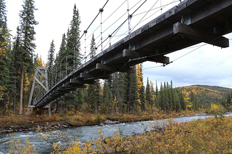
I always recommend walking the McKinley Station Trail to Hines Creek, then walking about 1/2 mile on the Triple Lakes Trail to reach the suspension bridge over Riley Creek (pictured below).
Walking the full trail to Riley Creek Campground provides lovely views of the creeks flowing through the boreal forest. The free Riley Creek Shuttle will bring you back to the Denali Visitor Center from the campground if you don’t wish to walk back.
The map below includes two connectors trails, Morino and Spruce Forest (detailed later on in this post). McKinley Station Trail is entirely accessible.
Difficulty: Moderate
Distance: 1.6 mi / 2.6 km one-way
Elevation Gain: 100 ft / 30 m
Estimated Time: 1-2 hours
Type of Trail: Out and back
Map: All Trails map
Trailhead Location: Denali Visitor Center or Riley Creek Campground
12. Tundra Loop
The Tundra Loop is a short trail you can walk from the Eielson Visitor Center. It’s the perfect length if you have a long bus ride and want to stretch your legs but stay with the same bus.
Throughout the summer, beautiful wildflowers will grow beside the trail. You’re also likely to see Arctic ground squirrels (or evidence of them) as you hike.
Furthermore, Park Rangers lead guided hikes along this route daily. Inquire with rangers at the Eielson Visitor Center for more information.
This trail is accessible.
Due to the road closure, this trail is currently inaccessible.

Difficulty: Easy
Distance: 0.3 mi / 0.5 km roundtrip
Elevation Gain: 52 ft / 16 m
Estimated Time: 15 minutes
Type of Trail: Loop
Map: All Trails map
Trailhead Location: Eielson Visitor Center
13. Meadowview Connector
There are four connector trails in Denali, and honestly, I dislike them all with this one exception.
If you visit Denali in the fall, you have to hike this trail. It provides one of the best views with some of the best fall colors, as you can see in the photo.
You can use this connector to make a great loop with the Rock Creek and Roadside Trails. For a shorter option, it also connects the Rock Creek and Roadside Trails with the Taiga Trail.
The walk up the trail can be steep, but the view is worth it.

Difficulty: Moderate
Distance: 0.3 mi / 0.5 km one-way
Elevation Gain:
Estimated Time: 15-30 minutes
Type of Trail: Out and back
Trailhead Location: Rock Creek Trail or Roadside Trail
14. Oxbow Loop
This trail is sort of a secret. You won’t find it on any of the trail maps park rangers provide. But it does exist, and it’s one of the best hikes in Denali National Park.
If you’re hoping for a quiet experience while visiting the park, aim to hike this trail.
You’ll walk through the spruce forest to a natural oxbow bend in the Nenana River. If you’d like, you can even climb rocks on the river side. Just be careful!

Difficulty: Easy
Distance: 1.5 mi / 2.4 km one-way
Elevation Gain: Negligible
Estimated Time: 1-2 hours
Type of Trail: Loop
Trailhead Location: Southern park entrance sign near the Nenana River bridge
15. Roadside Trail/Bike Path
Technically these are two different trails, but the only difference between the two is one is paved. They connect with one another seamlessly, which is why I’ve grouped them together here.
The Roadside Trail runs from the Park Headquarters area and continues along the road to the Denali Visitor Center.
From there, you can take the paved Bike Path to the entrance of the park at the Parks Highway intersection and even farther to the Glitter Gulch/Canyon shopping area if you wish.
As per the name, the Bike Path is the only trail in Denali that allows bicycles. The Bike Path and Roadside Trails are also the only trails dogs are allowed on – just make sure they are on a leash.

ROADSIDE TRAIL
Difficulty: Moderate
Distance: 1.8 mi / 2.9 km one-way
Elevation Gain: 350 ft / 106 m
Estimated Time: 1-2 hours
Type of Trail: Out and back
Map: All Trails map
Trailhead Location: Denali Visitor Center or Park Headquarters/Kennels
Note: Dogs are allowed on the Roadside Trail.

BIKE PATH
Difficulty: Easy
Distance: 1.7 mi / 2.7 km one-way
Elevation Gain: 150 ft / 45 m
Estimated Time: 1 hour
Type of Trail: Out and back
Trailhead Location: Denali Visitor Center, Park Entrance, or Glitter Gulch
Note: Dogs and bicycles are allowed on the Bike Path. This trail is accessible.
16. Taiga Trail
The Taiga Trail is another connector that provides access to many other popular trails in Denali.
Beginning from the Denali Visitor Center, you can take the Taiga Trail to access the Roadside, Rock Creek, Mount Healy Overlook, and Horseshoe Lake Trails.
It’s a nice trail to walk if you’re interested in the boreal forest ecosystem.

Difficulty: Easy
Distance: 1 mi / 1.5 km one-way
Elevation Gain: 75 ft / 23 m
Estimated Time: 1 hour
Type of Trail: Out and back
Map: All Trails map
Trailhead Location: Denali Visitor Center or Railroad Crossing
Note: The All Trails map shows the Taiga Trail forming a loop with the Bike Path.
17. Savage Cabin Loop
This trail is almost entirely unnecessary unless you’re on one of the Denali Natural History bus tours. These include a stop at the Savage Cabin where an interpreter provides some history before you walk the short trail with your bus driver.
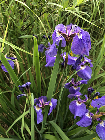
Otherwise, it’s a short, easy, accessible trail with little to see other than some pretty wildflowers. There are a few signs to tell you about the history of the area if you aren’t on one of the tours.
Difficulty: Easy
Distance: 0.8 mi / 1.3 km one-way
Elevation Gain: 50 ft / 15 m
Estimated Time: 1 hour
Type of Trail: Out and back
Map: All Trails map
Trailhead Location: Savage Cabin Parking Area
18. Spruce Forest Loop Connector
The Spruce Forest Loop is a small trail that connects with the McKinley Station Trail. You can use this to make your walk along McKinley Station shorter.
This trail is accessible.

Difficulty: Easy
Distance: 0.2 mi / 0.3 km one-way
Elevation Gain: Negligible
Estimated Time: 15-30 minutes
Type of Trail: Loop (with McKinley Station)
Trailhead Location: Denali Visitor Center/McKinley Station Trailhead
Note: For a map of the trail, see the McKinley Station Trail above. This trail is accessible.
19. Morino Loop Connector
The Morino Connector Trail is a small trail that connects with the McKinley Station Trail. You can use this to make your walk along McKinley Station shorter.
This trail is accessible.

Difficulty: Easy
Distance: 0.2 mi / 0.3 km one-way
Elevation Gain: Negligible
Estimated Time: 15-30 minutes
Type of Trail: Loop (with McKinley Station Trail)
Map: All Trails map
Trailhead Location: Denali Visitor Center/McKinley Station Trailhead
20. Jonesville Connector
The Jonesville Connector is another one of the most useful connector trails in the park. If you’re walking between Denali National Park and the shopping area known as Glitter Gulch, this trail shortens your walk.
It’s somewhat scenic, but the real reason to hike this trail is to shorten your walk.

Difficulty: Easy
Distance: 0.3 mi / 0.5 km one-way
Elevation Gain: Negligible
Estimated Time: 15-30 minutes
Type of Trail: Out and back
Map: All Trails map
Trailhead Location: Park Entrance/Riley Creek Campground
Pin The Best Hikes in Denali National Park
Have you ever been to Denali? What do you think the best hikes in Denali National Park are? What’s your favorite part about hiking in Denali?




Thanks for your blog, nice to read. Do not stop.
Thank you!
Thank you so much for your blog. Very well written. Easy to understand and follow. You helped us a lot in our trip to Denali!
I’m glad you had a great trip!
We are hoping to go in 2026, lots of great information here!