Article Summary: Best Hikes in Sequoia National Park
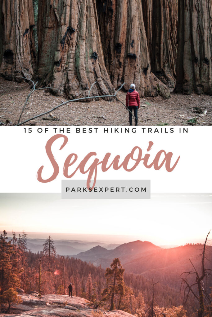
Sequoia National Park is a treasure trove of beauties that deserve to be explored. Whether you are looking for high-altitude mountain trails or lush forests populated with Sequoia trees, the best hikes in Sequoia National Park have something to offer every type of hiker.
It can be extremely difficult to choose where to hike when you visit Sequoia National Park, so I’ve put together a list of my fifteen favorite trails. These range from mountains to sequoias and are perfect for beginners or experts alike. Read through the best trails in Sequoia National Park to find the trail that’s best for you.
This post may contain affiliate links. If you make a purchase, I may earn a small commission at no additional cost to you. For more information, view my privacy policy.
Table of Contents
Sequoia National Park Overview
Location: California
Gateway Town: Three Rivers
Best Airport: The closest major airport is Fresno-Yosemite International Airport, about 2 hours from the Giant Forest and 1.5 hours from Three Rivers.
Best Time to Visit: Spring for wildflowers, summer for backpacking, fall for mild weather, winter for cross-country skiing and avoiding crowds
How to Get Around: Most of the year, you’ll need a vehicle to explore the park. The Sequoia Shuttle takes visitors from Visalia and the Foothills Visitor Center to the Giant Forest in the summer.
Pets: While technically allowed in the park, pets are not allowed on any trails.
Fee: $35 per vehicle, $30 per motorcycle, or $20 per pedestrian; entry is valid for 7 days
Reservations: Reservations are not required to enter the park.
Where to Stay: Three Rivers is the closest community to the park, and there are plenty of places to stay. There are also plenty of campgrounds in Sequoia or nearby Kings Canyon National Park.
Sequoia National Park Map
Click the image below to download/view a larger version.


What to Wear Hiking in Sequoia National Park
For more suggestions, read my posts on my favorite outdoor gear and the best daypacks for women.
The 10 Hiking Essentials
Every hiker should always carry the ten essentials with them. These include:

- Navigation systems: map, compass, and/or GPS
- Sun protection: sunscreen and/or ballcap
- Insulating layers: synthetic or down jacket, rain jacket, hat, gloves, and leggings
- Illumination (flashlight or headlamp)
- First-aid kit
- Something to light a fire: lighter, waterproof matches, and/or fire starter
- Repair kits and tools: pocket knife, duct tape, screwdriver, and/or scissors
- Emergency shelter: tent, bivy, tarp, and/or space blanket
- Nutrition: food for both meals and snacks
- Hydration: water bottle, water treatment (LifeStraw or SteriPen), and water
More from Sequoia National Park

Sequoia National Park Phone Case
Sequoia National Park Pennant

Fodor’s Guide to the 63 National Parks

Fodor’s Guide to Yosemite, Sequoia, and Kings Canyon

Sequoia & Kings Canyon Hiking Guidebook

Women’s National Parks Checklist T-Shirt

Women’s National Parks Checklist T-Shirt

Map of National Parks T-Shirt
Sequoia National Park Sticker
Sequoia National Park Pin
Sequoia National Park Patch

63 National Parks Water Bottle
Sequoia National Park

California National Parks Face Mask

The Last Season

Sequoia National Park Cross Stitch Kit

Sequoia and Kings Canyon National Parks Map
The 15 Best Hikes in Sequoia National Park
Sequoia National Park is the perfect place if you enjoy nature, hiking, and breathtaking scenery. Here are some of the best hikes in Sequoia National Park that are sure to excite your adventurous spirit.
1. General Sherman Tree Trail
This paved trail will lead you to see the largest tree in the world, General Sherman. You’ll walk down a hill from the parking lot and return by walking back up. There are interpretive panels along the way to teach you about the ecology of sequoias and the General Sherman Tree itself.
Read about the second-largest Sequoia, General Grant in Kings Canyon National Park, in my post about the 16 best trails in the national park system.
Note: This trail is located around 7,000 feet in elevation and is considered steep. Allow yourself time to acclimate and rest while you hike this trail. For those with physical disabilities, there is an accessible parking area with a shorter, accessible trail leading to the General Sherman Tree.

Difficulty: Moderate
Distance: 0.8 mi / 1.3 km one-way
Elevation Gain: 154 ft / 47 m
Map: All Trails map
Best For: Families
2. Big Trees Trail
This trail begins at the Giant Forest Museum and takes you through one of the park’s Sequoia groves. Along this accessible path, you’ll find hundreds of Sequoia trees. Waysides along the way will also answer commonly asked questions, such as why do Sequoias thrive in the High Sierra?
One of the best hikes in Sequoia National Park, the Big Trees Trail is also one of the most popular.

Difficulty: Easy
Distance: 1.4 mi / 2.3 km one-way
Elevation Gain: 50 ft / 15 m
Map: All Trails map
Best For: Families, wheelchairs, strollers
3. Congress Trail
The Congress Trail is an extension of the trail to the General Sherman Tree. Along the trail, you’ll see more of the world’s largest trees and interpretive displays so you can learn more about the Sequoias. It’s a mostly paved trail with some bumps and short inclines.
The trail includes the Senate and Congress groups along with the President Tree and the McKinley Tree. Are you noticing a theme?
My favorite tree along the Congress Trail is the Chief Sequoyah Tree. It’s tucked behind the President’s Tree. Be sure you don’t miss it.

Difficulty: Easy
Distance: 2 mi / 3.2 km loop
Elevation Gain: 230 ft / 70 m
Map: All Trails map
Best For: Families, wheelchairs, strollers
4. Congress-Trail of the Sequoias-Tharp’s Log-Congress Loop
To expand even further, you can take the Sherman Tree Trail to the Congress Trail to the Trail of the Sequoias to form a long loop. No matter which loop you choose, prepare to be in awe of these massive wonders. The trail is partially paved (from the Sherman Tree to the President’s Tree).
Of all the hikes in Sequoia National Park, this loop is one of my favorites. When hiking in Sequoia, it can be difficult to find solace and solitude. While you’re on the Trail of the Sequoias, you’ll see few other people. It’s wonderful to have the large trees all to yourself.
Note: AllTrails refers to this as the Giant Forest Loop, but this is NOT an official trail name. Make sure to note the true trail names to avoid getting lost while exploring the best hikes in Sequoia National Park. No signs in the park read “Giant Forest Loop”.

Difficulty: Easy
Distance: 7 mi / 11.3 km one-way
Elevation Gain: 1,282 ft / 391 m
Map: All Trails map
Best For: Families, seeing the big trees without the crowds, trail runners
5. Moro Rock
One of the most popular and best hikes in Sequoia National Park tasks you with climbing over 400 stairs to reach the top of Moro Rock for a spectacular view. The full panorama is truly breathtaking, both in beauty and intensity. The 400-stair climb is especially challenging at elevation for those who aren’t used to it, so take your time.
Note: Social distancing is not possible on the staircase. Please wear your mask on Moro Rock!
Safety: Moro Rock includes a strenuous climb up a staircase. It is unwise to hike this trail during periods of unhealthy air quality due to wildfire smoke or during thunderstorms where lightning strikes could occur.

Difficulty: Moderate
Distance: 0.6 mi / 1 km one-way
Elevation Gain: 300 ft / 91 m
Map: All Trails map
Best For: Rock climbing, views
6. Crystal Cave
This trail is partially paved. Along the way to the cave entrance, you’ll see impressive valley views and multiple waterfalls. If you hike the trail at the right time of year, you’ll also see beautiful wildflowers. Look out for poison oak!
Important Note: You must purchase tickets for the cave before your hike ($18 per person). You cannot hike the trail without a cave ticket. Tickets can be purchased online.

Difficulty: Moderate
Distance: 0.8 mi / 1.3 km one-way
Elevation Gain: 291 ft / 87 m
Map: All Trails map
Best For: Families, walking
Cost: $18
7. Tokopah Falls (Tokopah Valley Trail)
This rocky trail leads you two miles through the forest to a waterfall. You’ll walk through a valley along the Middle Fork of the Kaweah River, passing occasional meadows. The falls are best in spring as the snow melts from the higher peaks. In late summer, you may only see a trickle.
Even if the falls are dry, this remains one of the best hikes in Sequoia National Park. The valley is stunning with great views of the Watchtower above you.

Difficulty: Moderate
Distance: 2 mi / 3.8 km one-way
Elevation Gain: 630 ft / 192 m
Map: All Trails map
Best For: Families, walking, trail runners
8. Big Baldy Ridge
This lovely trail takes you up to a ridge for fantastic views. Along the way, you’ll walk through fields of wildflowers (if the season is right).

Difficulty: Moderate
Distance: 5.5 mi / 8.9 km loop
Elevation Gain: 1,391 ft / 424 m
Map: All Trails map
Best For: Wildflowers, walking, trail running, views
9. Ladybug Camp Trail
Another trail with marvelous diversity is the Ladybug Camp Trail. You’ll pass through Sequoia trees on your way to outstanding views.
Note: Due to the 2020 wildfires, use caution as you hike in this area. A significant portion of the trail area was burned.

Difficulty: Moderate
Distance: 7.2 mi / 11.6 km one-way
Elevation Gain: 1,952 ft / 595 m
Map: All Trails map
Best For: Families, backpacking, camping, mountain biking, trail running
10. Marble Falls
One of the park’s longer moderate trails is Marble Falls. You’ll walk through a deep canyon in the Foothills District of the park toward a waterfall. Look out for poison oak along the trail (remember, leaves of three!) and prepare for a strenuous climb.
I would not recommend this trail in the summer – it is challenging to find shade, and temperatures exceed 100 degrees all too often. If you insist on hiking to Marble Falls, go as early as you can. The best time to hike to Marble Falls is early spring (February or March).

Difficulty: Moderate
Distance: 7.4 mi / 12 km one-way
Elevation Gain: 2,150 ft / 655 m
Map: All Trails map
Best For: Walking, trail running, wildflowers
11. Lakes Trail to Heather Lake via Watchtower
In the Lodgepole area of the park, you’ll find a variety of trails to Sequoia groves, alpine lakes, and mountain vistas. The Lakes Trail will lead to all of these, and you can continue beyond Heather Lake if you wish to see more.
There are two routes to Heather Lake. One goes over “the hump”, a steep and strenuous climb, while the other climbs up the Watchtower. The Watchtower section is best in the summer; as soon as any ice is present, the trail is closed for the winter season in Sequoia.
Continue to Pear Lake to double your hiking distance on one of the most popular and best hikes in Sequoia National Park.

Difficulty: Moderate
Distance: 8.1 mi / 13 km one-way
Elevation Gain: 2,112 ft / 647 m
Map: All Trails map
Best For: Backpacking, horseback riding, snowshoeing, trail running, views
12. Mineral King Trail to Eagle Lake
You’ll be gaining elevation on this hike, rounding out at about 10,000 feet at Eagle Lake. Make sure you know you are prepared for the altitude. To make this a longer trip, you can connect with the Mosquito Lakes Trail.
This trail begins in Mineral King, one of the more secluded districts in Sequoia National Park. You’ll start in a valley, so no matter which hike you choose, prepare for a strenuous climb. Still, these are easily some of the best hikes in Sequoia National Park.

Difficulty: Strenuous
Distance: 7.2 mi / 11.6 km one-way
Elevation Gain: 2,200 ft / 671 m
Map: All Trails map
Best For: Hiking, trail running
13. Alta Peak
If you’re looking for a tough hike with grand rewards, go for Alta Peak. It’s challenging, so make sure you are up for an adventure. Enjoy the views from over 11,000 feet! The trail takes all day, especially at such a high altitude, so be sure to begin your hike early.

Difficulty: Strenuous
Distance: 7.5 mi / 12 km one-way
Elevation Gain: 4,500 ft / 1,372 m
Map: All Trails map
Best For: Experienced hikers, cross-country skiing, snowshoeing, trail running
14. Monarch Lakes via Sawtooth Pass Trail
This is a great day hike with wonderful views. If you’re interested in backpacking, you can continue by connecting with the Sawtooth Pass Trail (next on the list), which leads to more beautiful lakes.

Difficulty: Strenuous
Distance: 8.4 mi / 13.5 km round-trip
Elevation Gain: 2,500 ft / 762 m
Map: All Trails map
Best For: Backpacking, camping, hiking
15. Sawtooth Pass Trail
This strenuous trail leads to beautiful views of the Sawtooth Valley. You can also continue on to see the stunning Columbine Lakes.

Difficulty: Strenuous
Distance: 12.7 mi / 20.4 km round-trip
Elevation Gain: 4,313 ft / 1,314 m
Map: All Trails map
Best For: Hiking, rock climbing, backpacking
More Hikes in Sequoia National Park
Trails marked with an * are part of my top 15 best hikes Sequoia National Park.
| Trail Name | Distance | Elevation Gain | Difficulty Rating |
| Alta Peak* | 7.5 miles | 4,500 feet | Strenuous |
| Beetle Rock | 0.25 miles | 50 feet | Easy |
| Big Baldy Ridge* | 5.5 miles | 1,391 feet | Moderate |
| Big Trees* | 1.4 miles | 50 feet | Easy |
| Congress Trail* | 2 miles | 230 feet | Easy |
| Crescent Meadow Loop | 1.6 miles | 150 feet | Easy |
| Crystal Cave* | 0.8 miles | 291 feet | Moderate |
| Crystal Lake via Sawtooth Pass | 8.8 miles | 3,421 feet | Strenuous |
| Eagle Lake* | 7.2 miles | 2,200 feet | Strenuous |
| Franklin Lakes | 11.2 miles | 3,458 feet | Strenuous |
| Garfield Grove | 13.6 miles | 5,019 feet | Strenuous |
| General Sherman Tree* | 1 mile | 200 feet | Easy |
| Giant Forest Loop* | 7 miles | 1,282 feet | Easy |
| Hanging Rock | 0.35 miles | 100 feet | Easy |
| High Sierra to Bearpaw Meadow | 23 miles | 4,340 feet | Strenuous |
| Tar Gap Trail to Hockett Meadows | 18.3 miles | 2,887 feet | Moderate |
| Ladybug Camp Trail* | 7.2 miles | 1,952 feet | Moderate |
| Marble Falls* | 8 miles | 2,150 feet | Moderate |
| Middle Fork Kaweah | 24.7 miles | 5,639 feet | Strenuous |
| Monarch Lakes via Sawtooth Pass* | 8.4 miles | 2,500 feet | Strenuous |
| Moro Rock* | 0.6 miles | 300 feet | Moderate |
| Mount Langley | 22 miles | 4,000 feet | Strenuous |
| North Fork Kaweah River | 9.2 miles | 1,184 feet | Easy |
| Paradise Creek | 6 miles | 1,007 feet | Easy |
| Sawtooth Pass* | 12.7 miles | 4,314 feet | Strenuous |
| Sunset Rock | 2 miles | 100 feet | Easy |
| Timber Gap | 9.8 miles | 4,110 feet | Strenuous |
| Tokopah Falls* | 4.2 miles | 630 feet | Moderate |
| Watchtower* | 8.1 miles | 2,112 feet | Moderate |
| White Chief Canyon | 7.1 miles | 2,230 feet | Strenuous |
Pin Best Hikes in Sequoia National Park
With its towering trees and steep canyons, it’s no wonder that many people choose some of the best hikes in Sequoia National Park to explore. There are so many hiking trails within the national park that you could spend your entire lifetime exploring them all!
We hope this post helped you decide which trails in Sequoia are best for you. From Alta Peak at 12,000 feet elevation to Moro Rock for panoramic views, there’s something for everyone in Sequoia National Park.