Article Summary: Capitol Reef Best Hikes, Hiking Capitol Reef
Undoubtedly, one of the best ways to see Capitol Reef National Park is on foot. While there are plenty of other things to do and see in the park, to understand its majesty is to immerse yourself in its wildness.
Our favorite hikes in Capitol Reef National Park are below. You’ll find everything you need to know, including distances, elevation changes, detailed descriptions, and safety information. We hope you enjoy hiking in Capitol Reef National Park!
This post may contain affiliate links. If you make a purchase, I may earn a small commission at no additional cost to you. For more information, view my privacy policy.
Table of Contents
Capitol Reef National Park Overview
IMPORTANT: The Scenic Drive will close for construction beginning April 29, 2024. It’s expected to be completed by fall 2024. The closure will be from the entrance station to Capitol Gorge. This closure will impact the Chimney Rock, Hickman Bridge, and Grand Wash parking areas. Check this page for updates.

How to Get to Capitol Reef National Park
The closest airport to this remote national park is Salt Lake City (SLC), about 218 miles and 3.5 hours from Capitol Reef. From here, it is best to rent a car to visit the park. In the small gateway community of Torrey, there are no transportation services. To get to the various trailheads in Capitol Reef, you will be thankful you have a car. Check Expedia for the best deals on flights and rental cars!
Depending on where you’re coming from, you will take Interstate 70 or Interstate 15 to State Route 24. Cell reception is spotty, so it’s best to plot this in your GPS in advance or have a map on hand.
If you’re coming from Zion or Bryce Canyon, we highly recommend Route 12, one of the most scenic drives I’ve ever taken!
For more detailed directions to Capitol Reef, visit the official website.
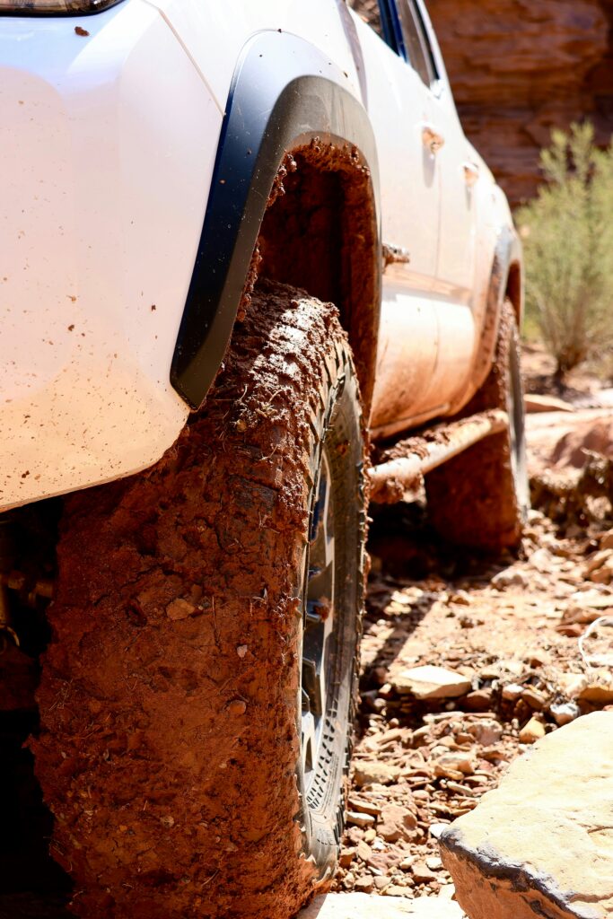
PARKS EXPERT TIP: If you’re planning to drive the unpaved roads in the park (there are many!), we strongly recommend renting a 4-wheel drive vehicle. An all-wheel drive vehicle is a good backup option, but you’ll want to make sure it has high clearance.
Best Time to Go Hiking in Capitol Reef National Park
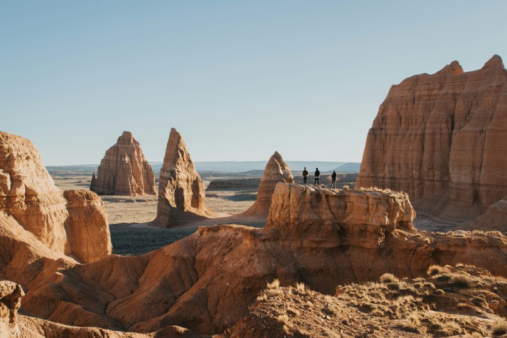
March to June and September to October are the most popular times to visit the park. It’s no coincidence as this is also when the park generally experiences its best weather. There’s less chance for monsoons, snowstorms, or other threats this time of year.
Monsoon season is from July to September. If rain or storms are expected during your trip, know where to seek shelter. Flash floods can be deadly.
If you can, visit during the week. The park is busiest on Saturdays, Sundays, and holidays. Remember to hike early or late in the day to avoid the heat. Cathedral Valley and the Waterpocket Fold are the least visited areas of the park (compared to Fruita and the Scenic Drive) if you hope to avoid crowds.
We highly recommend that you have a backup plan in case conditions prevent you from hiking the trail you want.
How Long to Spend in Capitol Reef National Park
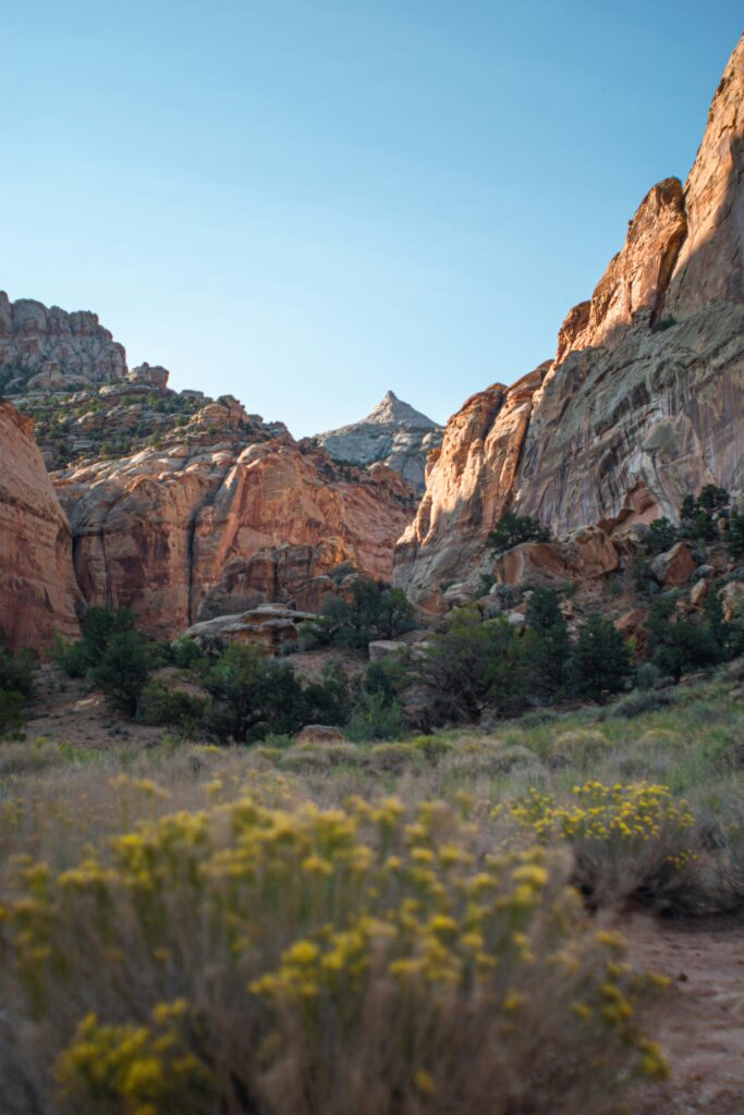
More often than not, Capitol Reef seems to be a waypoint for visitors between the more popular Utah national parks, like Arches and Bryce Canyon. This is a shame, as the park is just as special as its neighbors.
Still, if you have a few hours, you can squeeze in one of the short, easy hikes below.
If you have more time, try to spend at least one full day in Capitol Reef. This will be the best way to do our favorite hikes and see this incredible park first-hand. This will allow for longer hikes, such as Cohab Canyon or Chimney Rock.
To get the most out of hiking trails in Capitol Reef, stay for a few days and enjoy the view.
For more trip planning advice, read our Expert Travel Guide to Capitol Reef.
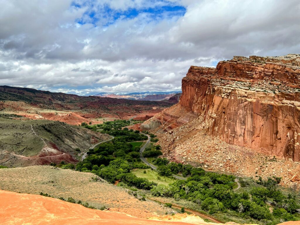
How Much Does Capitol Reef National Park Cost?
Visitors can purchase vehicle passes ($20), motorcycle passes ($15), or pedestrian passes ($10) at the entrance station on the Scenic Drive. These passes are valid for 7 days. If you visit often, there’s also a $35 annual pass that’s valid only in Capitol Reef.

If you’re visiting other national parks in Utah, consider purchasing an America the Beautiful pass. This $80 pass grants access to all federal public lands for 12 months. The Mighty Five in Utah all charge entrance fees, so this pass will save you a ton of money down the road.
Leave No Trace and Hike Smart

When visiting our national parks and public lands, please practice Leave No Trace principles. Plan ahead, choose durable surfaces for camping or hiking, dispose of all waste properly, leave everything you find, minimize campfire impacts, respect wildlife, and be considerate of other park visitors.
Elevation: The average elevation in Capitol Reef is 5,500 feet above sea level with some trails reaching almost 7,000 feet. It’s important to consider this when deciding which Capitol Reef hikes to take on. This is especially true if you’re visiting from a lower elevation.
Weather: Temperatures can vary wildly in the desert. In May, temperatures can soar into the 90s or 100s! Try to hike in the early morning or in the evening to avoid the heat of the day. Many trails have little to no shade and water isn’t available near the trailheads.
Water: ALWAYS carry water to avoid heat-related illnesses. Keep an eye on the forecast for heavy rains and flash flood warnings.
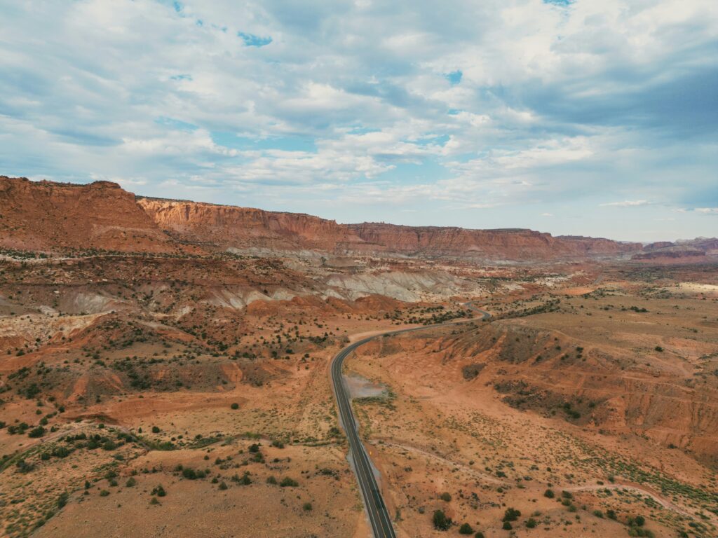
Stay on the Trail: The soil in Capitol Reef is special! No, really. Biological soil crusts teeming with life are everywhere and the environmental impacts are dismantling them. “Don’t bust the crust!” Here’s a quote from the National Park Service:
Although it may just look like dirt, biological soil crusts are full of living organisms like lichens, mosses, algae, micro fungi, and bacteria. In the high deserts of the Colorado Plateau (which includes parts of Utah, Arizona, Colorado, and New Mexico), biological soils may represent 70 to 80 percent of the living ground cover!
National Park Service
Leave Petroglyphs and Cultural Resources: Capitol Reef National Park is filled with valuable archaeological resources. To protect the human history of the park, leave everything you find. The best way to preserve petroglyphs is not touching them.
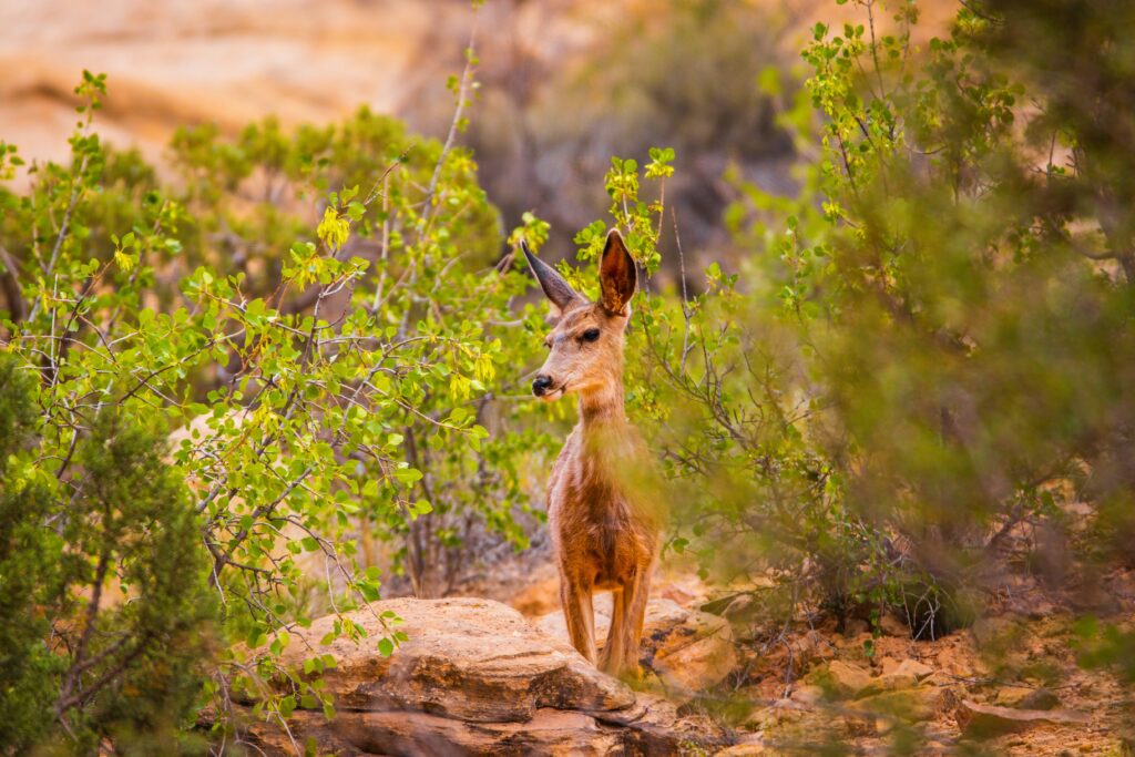
Respect Wildlife: Remember that you are hiking in their national park, and it’s their home. Do not disturb, approach, or feed wildlife. The largest threats are mountain lions (a very rare sighting, but be prepared) and diseases transmitted from animals. As long as you give them their space, diseases shouldn’t be an issue.
Is Capitol Reef National Park Pet Friendly?
The short answer is no. Not if you are hiking in Capitol Reef. Pets are not allowed on Capitol Reef trails, anywhere in the backcountry, or inside public buildings.
You can’t leave your pets unattended and there aren’t any kennel options in the park. There is a kennel in Torrey if needed. Don’t leave your pets in your car as temperatures can rise quickly.
Leashed pets are allowed on the trail between the visitor center and Fruita Campground, the Freemont River Trail (campground to Hattie’s field gate), unlocked orchards, picnic areas, campgrounds, roads, and parking areas. Leashes must be 6 ft (1.8 m) or shorter.
Generally, it’s best to hike in national parks without your pet(s).
Capitol Reef National Park Map

You are encouraged to click on the map above to enlarge it and download it.
Notice that Capitol Reef is a very long and skinny park. Some attractions are quite far from one another, particularly with the number of unpaved roads.
The 20 Best Capitol Reef National Park Hikes
Here’s a quick list of our favorite hikes in Capitol Reef National Park. We’ll go into detail about each of these below. They are listed in order of their difficulty (easy to strenuous) and length (shortest to longest).
- Upper Cathedral Valley Overlook
- Goosenecks to Sunset Point
- Capitol Gorge
- Surprise Canyon
- Grand Wash
- Cathedrals Trail
- Headquarters Canyon
- Hickman Bridge
- Strike Valley Overlook
- Freemont River Trail
- Cohab Canyon
- Lower Cathedral Valley Overlook
- Cassidy Arch
- Golden Throne
- Freemont Gorge Overlook
- Rim Overlook
- Frying Pan Trail
- Chimney Rock
- Old Wagon Trail
- Navajo Knobs
Our Top Five Capitol Reef Hikes (in no particular order): Goosenecks to Sunset Point, Cassidy Arch, Hickman Bridge, Chimney Rock, Navajo Knobs
Best for First-Timers: Goosenecks to Sunset Point, Upper Cathedral Valley Overlook, Cathedrals Canyon, Hickman Bridge
Short and Easy: Goosenecks to Sunset Point, Capitol Gorge, Surprise Canyon
Least Crowded: Golden Throne, Old Wagon Trail, Strike Valley Overlook, Fremont Gorge Overlook, Rim Overlook to Navajo Knobs
Hiking Difficulty Levels Explained
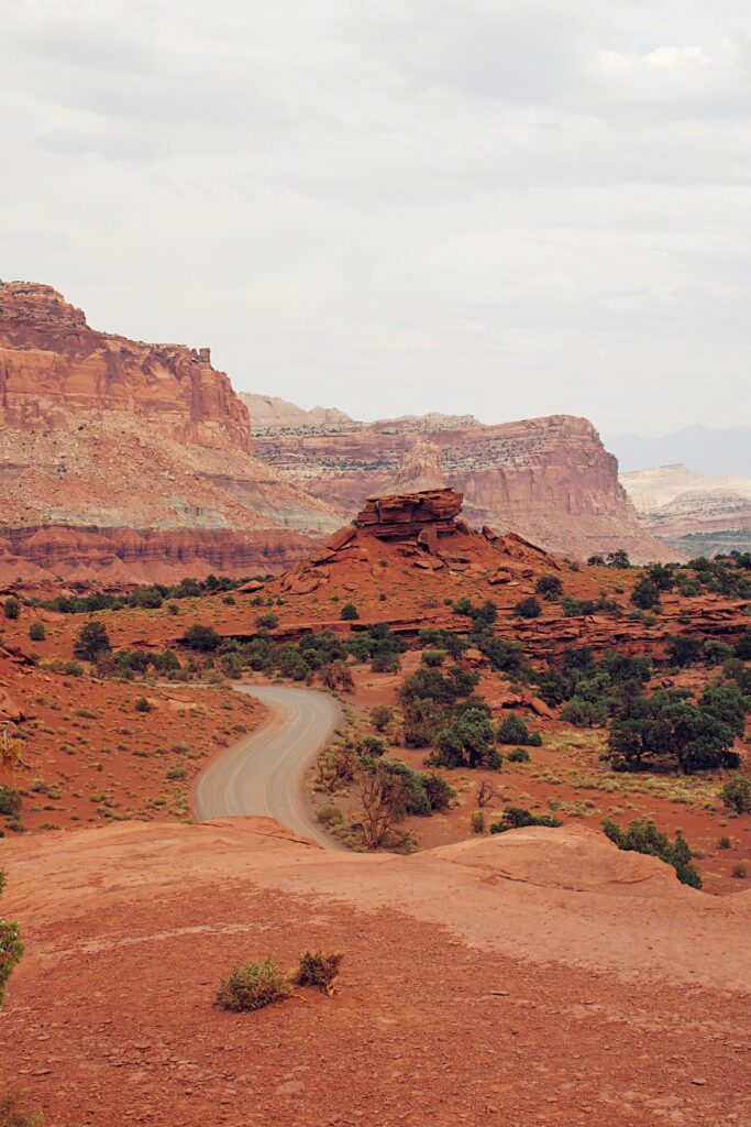
Easy trails have uneven ground but are fairly flat.
Moderate trails have some steep sections in addition to level sections.
Strenuous trails are entirely steep and uneven. They often involve long and steady climbs.
Remember, with elevations over 5,000 feet, even easy trails can be difficult for someone who isn’t acclimated.
Upper Cathedral Valley Overlook
Difficulty: Easy
Distance: 0.2 mi (0.3 km) round-trip
Elevation Change: Negligible
Estimated Time to Complete: Less than 30 minutes
Pets: No
Access: Unpaved road, best with an SUV or 4×4
Trailhead: Hartnet Road
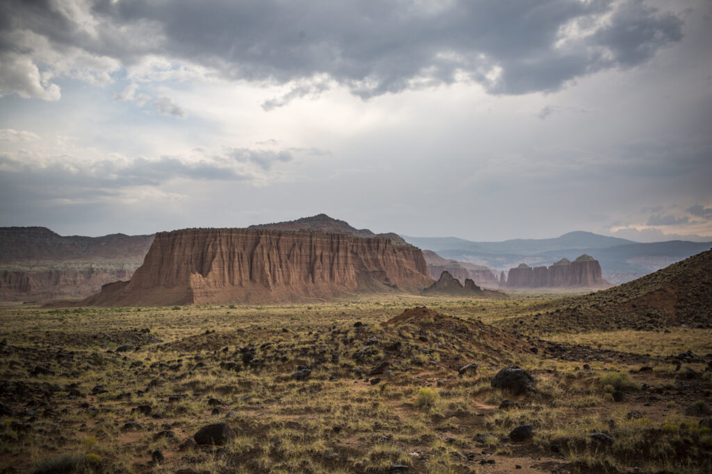
This short trail has rewarding views of the valley, known as “The Cathedrals”, below.
If you choose to do any of the more strenuous hikes in this valley, it’s neat to get a birds-eye view of it as well.
There’s a picnic table if you want to have some lunch or a snack.
Goosenecks to Sunset Point
Difficulty: Easy
Distance: 0.9 mi (1.4 km) round-trip
Elevation Change: 100 ft (30.5 m)
Estimated Time to Complete: 30 to 45 minutes
Pets: Not allowed
Access: Unpaved road, standard vehicles okay
Trailhead: Parking area at the end of Goosenecks Road
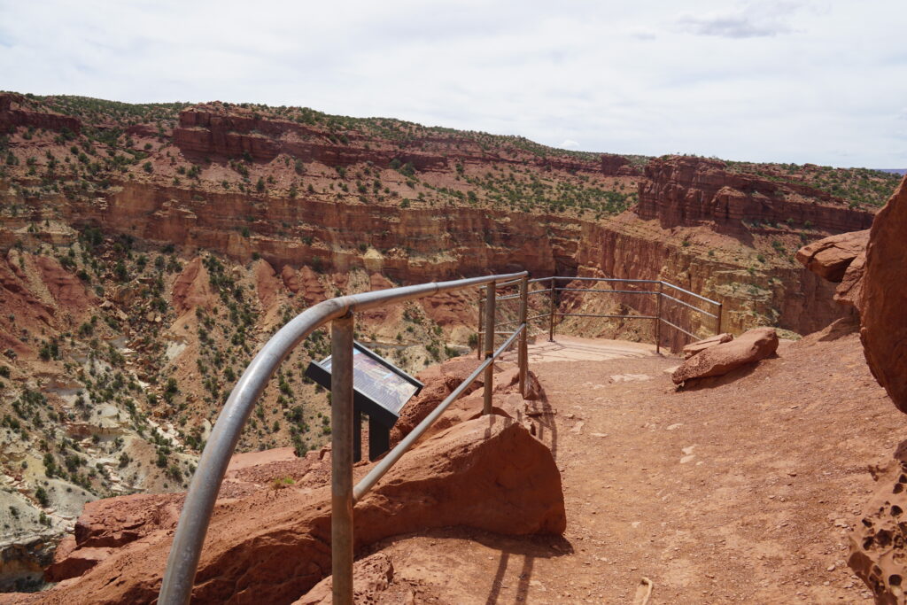
This short and easy hike allows you to tackle two scenic vistas in one trip.
Technically two different trails, they are easily combined for a quick out-and-back trek. Simply choose which short trail to go down first and follow it with the other. Goosenecks Trail is the shortest (0.1 mi/0.2 km one-way) followed by Sunset Point (0.4 mi/0.6 km one-way).
There are some sheer drop-offs, but otherwise, this is an excellent trail for kids and families.
Sunset Point is, of course, an excellent place to watch the sunset. For this, we recommend arriving 30-60 minutes before sunset to secure your parking spot. Bring a headlamp so you can safely return to your vehicle in the dark. If you can’t make it for sunset, don’t worry, the views are great all day long!
Don’t forget to stop at Panorama Point on your way to the trailhead for more stunning views. This portion of the road is paved if you’re nervous about taking your vehicle on an unpaved road.
Capitol Gorge
Difficulty: Easy
Distance: 1 mi (1.6 km) one-way
Elevation Change: 80 ft (24 m)
Estimated Time to Complete: 45 minutes
Pets: No
Access: Unpaved road, standard vehicles okay (under 27 feet)
Trailhead: Capitol Gorge Road
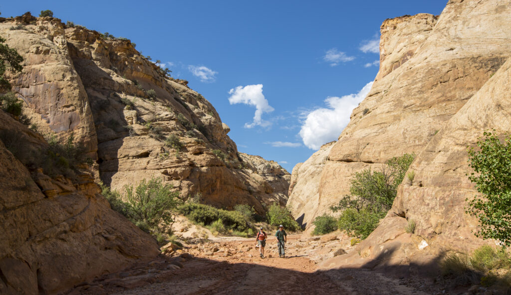
This short trail follows an old road through a wide canyon. This was the original road through the waterpocket fold. It’s a dirt path but it’s relatively level.
At the end of the trail is a wall of petroglyphs. It’s known as the Pioneer Register. Mormon settlers passing through carved their names onto the walls.
You’ll pass several other petroglyphs and wall art as you hike as well. Remember to Leave No Trace! This historic graffiti is carefully monitored by law enforcement.
There are other routes to take from here, but we strongly encourage you to turn around at the Pioneer Register. The sign for the Tanks Trail is another good turnaround point. The full trail runs about 4.5 miles.
Surprise Canyon

Difficulty: Easy
Distance: 2 mi (3.2 km) round-trip
Elevation Change: 423 ft (129 m)
Estimated Time to Complete: 1-2 hours
Pets: No
Access: Paved and partially unpaved road, standard vehicles okay
Trailhead: Burr Trail Road
If you want to explore the Waterpocket Fold, this is an excellent place to hike. Cairns will mark your way after passing over a grassy drainage and dry Halls Creek bed. You’ll be led into a pretty narrow canyon until the trail ends at a rockfall.
Grand Wash
Difficulty: Easy
Distance: 2.2 mi (3.6 km) one-way
Elevation Change: 200 ft (61 m)
Estimated Time to Complete: 1 to 2 hours
Pets: No
Access: Unpaved road, standard vehicles okay
Trailhead: Grand Wash/Cassidy Arch Trailhead on East Grand Wash Road
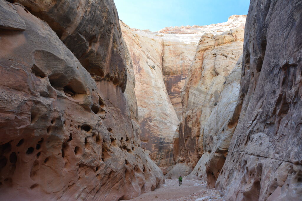
If you want to feel small, hike this trail.
You’ll follow a dry streambed through a deep canyon. Looking up, you’ll see millions of years of geologic history. This easy trail is another great option for kids and families.
This trail also features The Narrows (not to be confused with Zion’s Narrows!), a portion of the canyon that narrows to about 15 feet. This is about 1-mile from the start of the trail in case you don’t want to do the entire route. This shortens your hike to 2-3 miles and about 1 hour round-trip.
For a shorter 20-30 minute hike, you can begin at “Lower Trailhead” on State Route 24. If you have two cars/drivers, you can carpool to hike from one end to the other (Cassidy Arch trailhead). Begin at the Grand Wash/Cassidy Arch trailhead for a slow descent into the canyon and a slightly longer walk.
Since one trailhead is shared with Cassidy Arch, you can easily combine the two trails if you only have one day in Capitol Reef National Park.
It’s important to check the weather forecast before this hike. If there are storms in the forecast, pick another day to do this trail.
Cathedrals Trail
Difficulty: Easy
Distance: 2.4 mi (3.9 km) round-trip
Elevation Change: 324 ft (99 m)
Estimated Time to Complete: 1 to 2 hours
Pets: No
Access: Unpaved road, 4×4 is recommended
Trailhead: Cathedral Road, north of the junction with Hartnet Road
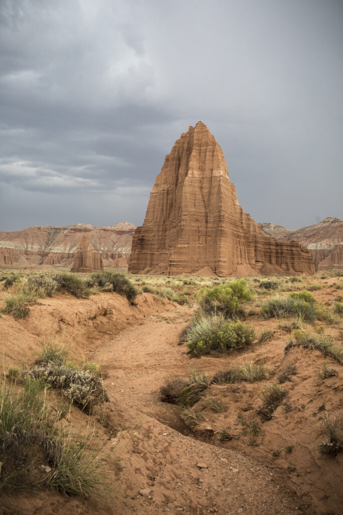
This trail follows a low ridgeline in the valley known as the Cathedrals. The ridge parallels a line of monoliths, as seen from the Upper Cathedral Valley Overlook.
If you want to get a closer look at the huge rock formations you saw from the Overlook, this trail is worth the walk. Some of these are famously named Temple of the Sun and Moon.
The trail can be difficult to find, but there is a small sign for it. Look for it about 2.5 miles north of the Hartner Road junction.
After a brief but steep climb, the rest of the walk is relatively level. There’s a small hill at the end with the best views of the valley.
This trail is very rewarding in terms of amazing views in a short walk. It’s worth the steep climb at the beginning to take in the scenery.
Headquarters Canyon

Difficulty: Easy
Distance: 3.2 mi (5.2 km) round-trip
Elevation Change: 406 ft (124 m)
Estimated Time to Complete: 2 to 3 hours
Pets: No
Access: Unpaved road, standard cars okay
Trailhead: Burr Trail Road
This one can be challenging to find. But once you get there, it’s totally worth it.
This trail is similar to Surprise Canyon but less crowded and some might say more beautiful. It is even more narrow than Surprise Canyon! The views and experience are similar, but I would choose Headquarters if I had a choice. This is mostly for the striped Navajo sandstone walls – it’s gorgeous!
To get there, follow Burr Trail Road. There’s a signed area where you’ll leave your vehicle and depart on foot.
Follow the drainages until you read the canyon. Less than one mile in, you’ll find the narrow slots. Squeeze your way through to discover lush vegetation on the other side. The trail ends at a 6-foot ramp-like sandstone rock.
Hickman Bridge
Difficulty: Moderate
Distance: 0.9 mi (1.4 km) one-way
Elevation Change: 400 ft (122 m)
Estimated Time to Complete: 2 to 3 hours
Pets: No
Access: Paved road, all vehicles okay
Trailhead: Parking area off of State Route 24
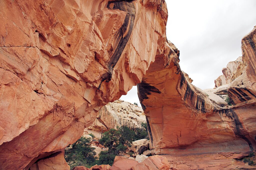
This popular trail leads to a 133-foot natural bridge as you trek by stunning canyon views. You’ve likely seen photos of this beautiful bridge before while planning your visit to Capitol Reef.
In its short distance, there is a good amount of elevation gain. There is loose rock along the way as well, so be careful not to lose your footing. If you have adventurous kids who can handle the uneven terrain, they’ll love this.
This hike reminds me a lot of the hike to Delicate Arch with its steep ascent and surprise arch at the trail’s end. Also similar to the Delicate Arch, you can walk underneath this natural arch.
If you want to learn about the area as you hike, there’s a trail guide available to purchase for a mere 50 cents. We thought this was well worth it, especially if you need some breaks on the steep incline.
Since the trail is relatively short and moderately difficult, it’s very popular. Arrive early, especially on weekends or holidays. The early evening is another good time to try to hike this one.
Strike Valley Overlook
Difficulty: Moderate
Distance: 0.9 mi (1.4 km) round-trip
Elevation Change: 400 ft (122 m)
Estimated Time to Complete: 30 minutes to 1 hour
Pets: No
Access: Unpaved road, 4×4 required
Trailhead: Upper Muley Twist/Strike Valley Overlook Road
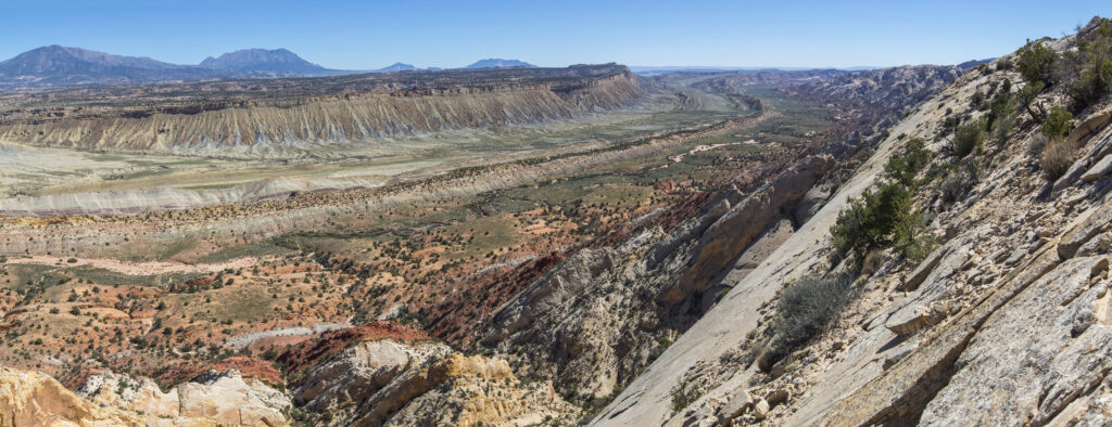
The Strike Valley Overlook is extremely difficult to get to. The road can be rough and the park requires visitors to have a 4-wheel drive, high-clearance vehicle to make the trip.
For those who can make it, the short hike yields amazing views of sedimentary rock layers. These display approximately 150 million years’ worth of geologic history!
This trail requires climbing some slickrock, so make sure your shoes have good traction!
Your climb ends when you reach an overlook marked with a large cairn.
If you’re determined you can hike on the road to reach the trailhead. This makes your hike add up to about 6 miles round trip. In my opinion, if you don’t have the right vehicle, you can skip this one. There are similar viewpoints you can access without completing this trek.
Fremont River Trail
Difficulty: Moderate
Distance: 1 mi (1.7 km) one-way
Elevation Change: 480 ft (146 m)
Estimated Time to Complete:
Pets: Yes (from the Fruita Campground to the Hattie’s Field gate)
Access: Paved road, all vehicles okay
Trailhead: Fruita Campground
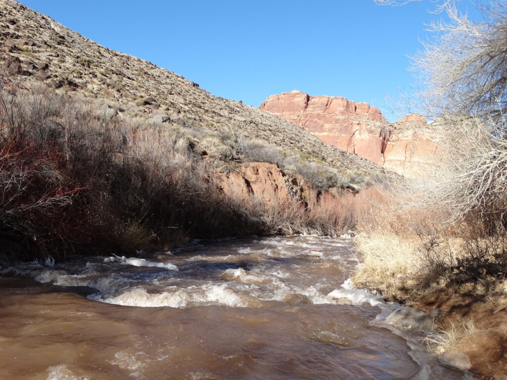
I wouldn’t call this the best hike in Capitol Reef National Park by any stretch. That said, it’s one of the few that allows pets, which makes it the best trail for dog owners.
NOTE: Pets are only permitted between the campground and the gate at Hattie’s Field.
The trail leaves from the Fruita Campground and ends on top of a rim overlooking the orchards. The climb is steep at the end, but the views are worth it. You can look back on what you accomplished with pride! The lush greenery is a nice surprise, too.
Make sure your dog is on a leash. This is park policy to protect you and your pet from any threats, including unwanted wildlife encounters.
Cohab Canyon
Difficulty: Moderate
Distance: 1.7 mi (2.7 km) one-way
Elevation Change: 440 ft (134 m)
Estimated Time to Complete: 2 to 3 hours
Pets: No
Access: Paved road, all vehicles okay
Trailhead: Hickman Bridge parking area off State Route 24
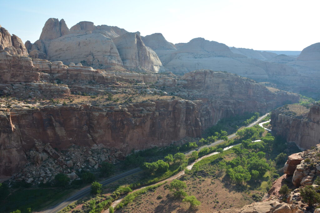
For a better overlook of similar features to the Fremont River Trail, Cohab Canyon is a winner.
The trail starts with a steep climb, but it levels out. Not only will you be rewarded with beautiful Fruita views, you’ll also encounter slot canyons (known as “The Wives”), sandy washes, and slickrock. To see the Fruita views, make sure you don’t skip the Cohab Canyon Fruita Overlooks Trail 1-mile into the hike, which brings you to North and South overlooks.
This is another hike with significant portions of slickrock, so wear shoes with good traction.
This is one of the best hikes in Capitol Reef National Park if you’re seeking some shade.
Reward yourself with a pie from the Gifford House after your hike, you’ve earned it!
Lower Cathedral Valley Overlook

Difficulty: Moderate
Distance: 1.5 to 2.5 mi (2.5 to 3.9 km) round-trip
Elevation Change: 150 ft (46 m)
Estimated Time to Complete: 1 to 2 hours
Pets: No
Access: Unpaved road, 4×4 recommended
Trailhead: Hartnet Road
If you’re interested in a bird’s eye view of the Temples of the Sun and Moon, this is a great option. This route is longer than its Upper Cathedral Valley Overlook counterpart. We recommend it if you have the time.
Find the faint path by a wooden sign with a diagram of the ridge ahead. Then, there’s a short, steep climb to a rim overlooking the Lower Cathedral Valley. Other than this jaunt, the trail is completely flat.
If you’re interested in another viewpoint, turn back and follow a sandy wash to the north. There’s not really a trail here, but you can connect the two saddles easily enough. You might be able to locate a faint footpath to follow. There’s about 1 mile between them.
You can make a loop that is 2.5 miles or only visit the first overlook and then turn back for a shorter hike.
I honestly prefer the Upper Overlook. This one is, in my opinion, too far away to appreciate the Cathedral Valley.
Cassidy Arch
Difficulty: Strenuous
Distance: 1.7 mi (2.8 km) one-way
Elevation Change: 670 ft (204 m)
Estimated Time to Complete: 2 to 3 hours
Pets: No
Access: Unpaved road, standard cars okay
Trailhead: Grand Wash Road off of Scenic Drive
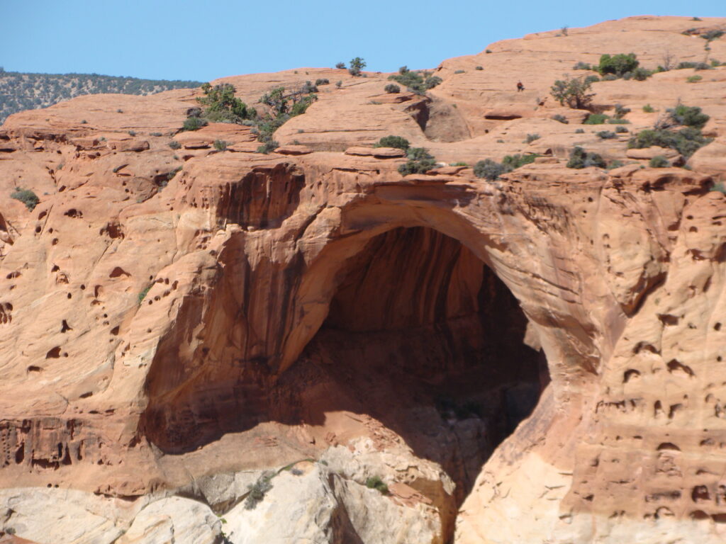
This is one of the most popular hikes in Capitol Reef National Park. This natural arch is perched above the beautiful valleys and canyons below. It’s rumored that Butch Cassidy used the nearby Grand Wash as a hideout, hence the arch’s name.
This is the first of our strenuous Capitol Reef hikes, and we aren’t kidding around. This is a tough climb, but we find the reward to be worth it. If you hate switchbacks, maybe skip this trail.
Start your hike on the Grand Wash Trail before it branches off to Cassidy Arch on your left. The trail is well-marked with signs, arrows, and elevations. Then, traverse the dreaded switchbacks for about ¼-mile before ascending to some epic viewpoints.
There’s another split about 1-mile down the trail. Continue left again. The trail is trickier from here, so keep your eyes peeled for cairns. These will lead you across slickrock to the best views of Cassidy Arch. If you have AllTrails or Gaia, you might consider downloading an offline map of this route as an aid.
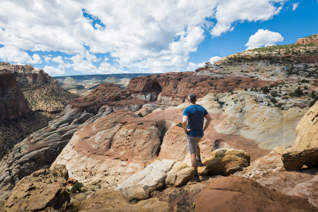
We recommend this extra jaunt if you have the time. If you stay further away, the arch looks more like a cave than an arch. If you’re feeling extra adventurous, you can even stand on top of the arch (don’t worry, it’s surprisingly wide).
There is no shade on this hike, so bring lots of water and sun protection. Shoes with good traction will come in handy, too.
If you only have time for one hike in the park and you’re up for a challenge, this is the trail you should choose.
Hikers with young children or a fear of heights may want to avoid this trail. It’s completely exposed most of the way.
Golden Throne
Difficulty: Strenuous
Distance: 2 mi (3.2 km) one-way
Elevation Change: 730 ft (223 m)
Estimated Time to Complete: 1 to 2 hours
Pets: No
Access: Unpaved, standard cars okay
Trailhead: Capitol Gorge Road
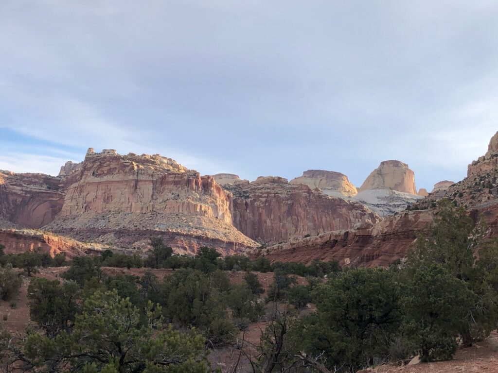
This is a great trail for views of the Capitol Groge and Golden Throne formations. Keep in mind, however, that it is a difficult hike. It’s another good hike for anyone interested in higher vantage points.
The trail will gain elevation from the beginning. Thankfully, this doesn’t last long. After 15 minutes or so of climbing, the trail will level out a bit. But don’t be fooled. You’ll still be climbing, just more gradually.
Beginning about halfway down the path, you can see the Golden Throne formation to the northeast as you continue. The trail’s end at its base will also offer views of Boulder Mountain, Capitol Gorge, and the Henry Mountains. The end is a nice spot for a water and snack break before you descend the same way.
Fremont Gorge Overlook
Difficulty: Strenuous
Distance: 2.3 mi (3.6 km) one-way
Elevation Change: 1,090 ft (332 m)
Estimated Time to Complete: 1 to 2 hours
Pets: No
Access: Paved road, standard vehicles okay
Trailhead: Old Blacksmith Shop on Scenic Drive
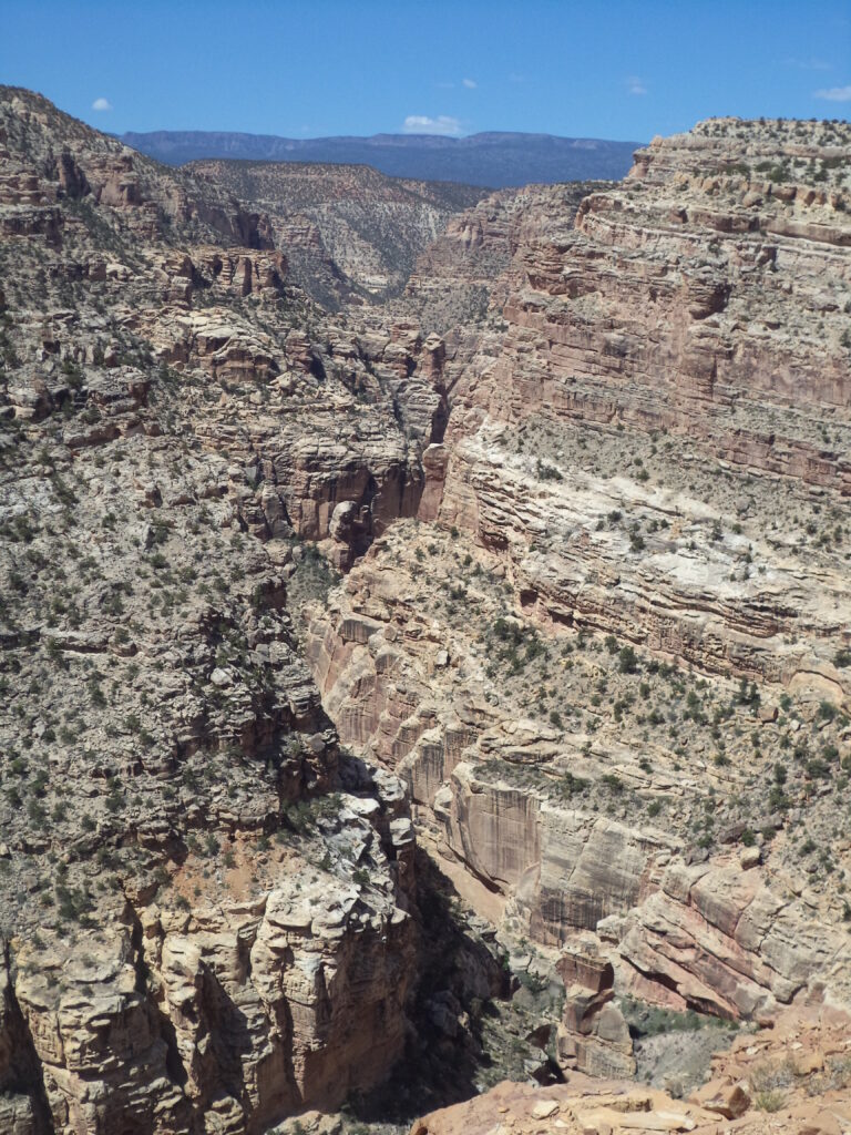
To truly appreciate the erosion that has taken place over millions of years, this is an excellent trail to hike. You’ll see vast views of the surprisingly deep Fremont River Gorge.
There is no shade, so bring plenty of water and avoid hiking at the hottest time of the day. This is not a good hike to do in the summer.
To begin, you’ll follow the road from the Blacksmith shop a short way. Round the bend and then begin on the trail. The trail is very steep from here as you climb to the top of the mesa and the final viewpoint. You’ll get a break from climbing in the middle of the trail, but it’ll pick up again.
You’ll be treated to incredible views of the Waterpocket Fold, Fruita, and Fremont River. The trail itself isn’t very exciting, but the views are spectacular.
This is one of the more difficult hikes in Capitol Reef. Know your limits and abilities.
Rim Overlook
Difficulty: Strenuous
Distance: 2.3 mi (3.6 km) one-way
Elevation Change: 1,110 ft (338 m)
Estimated Time to Complete: 2 to 3 hours
Pets: No
Access: Paved road, all vehicles okay
Trailhead: Parking area off State Route 24
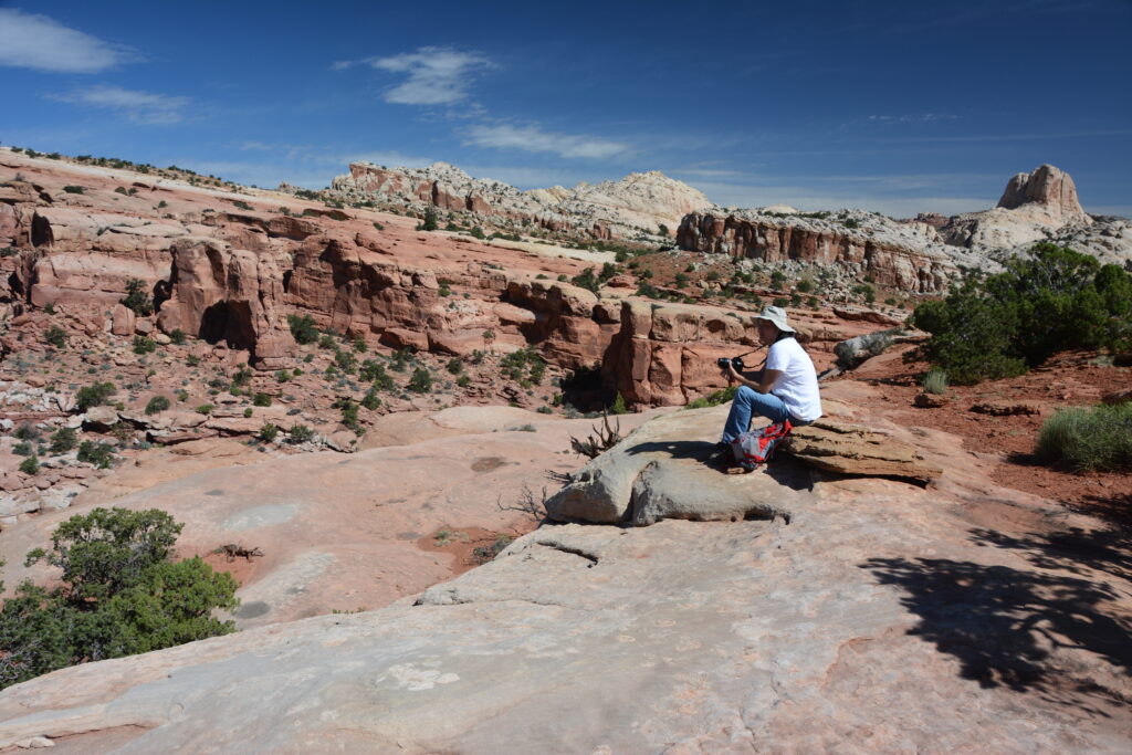
Climb to the top of this dramatic formation for panoramic views of Fruita and the Waterpocket Fold. If you want similar views to Cohob Canyon, but a more challenging hike or fewer people, this is a great option.
Hickman Bridge also begins from this trailhead if you have enough energy for multiple Capitol Reef hikes.
If you’re up for it, you can continue on the Navajo Knobs Trail (#20 on this list).
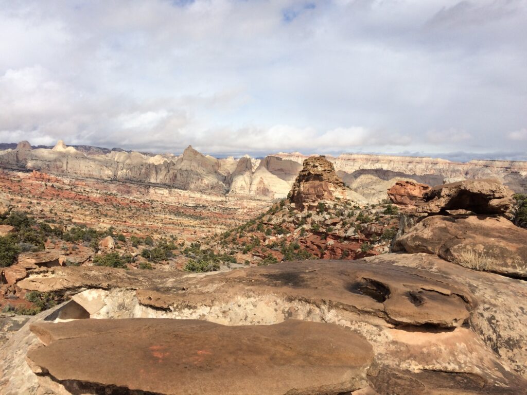
Frying Pan Trail
Difficulty: Strenuous
Distance: 2.9 mi (4.6 km) one-way
Elevation Change: 730 ft (223 m)
Estimated Time to Complete: 5 to 7 hours (when combined with nearby trails)
Pets: No
Access: Paved road, all vehicles okay
Trailhead: Cassidy Arch/Hickman Bridge or Grand Wash on State Route 24
To make a long hike of the Cassidy Arch, Cohab Canyon, and Grand Wash trails, consider hiking the connecting Frying Pan Trail.
Note that you won’t start and end in the same place. This will begin at the Cassidy Arch/Hickman Bridge Trailhead and end at the Grand Wash parking area on State Route 24.
It’s best to hike this trail with two cars and two drivers so you can stage a vehicle at the end. If you can manage to work out the logistics, it’s a worthwhile hike.
It’s nice to hit three of the best hikes in Capitol Reef National Park in one day. The best direction, in my opinion, is to hike from Hickman Bridge to Grand Wash so you end with a nice, slow descent.
Chimney Rock Loop Trail
Difficulty: Strenuous
Distance: 3.6 mi (5.9 km) round-trip
Elevation Change: 590 ft (180 m)
Estimated Time to Complete: 2 to 4 hours
Pets: No
Access: Paved road, all vehicles okay
Trailhead: Turnout on State Road 24
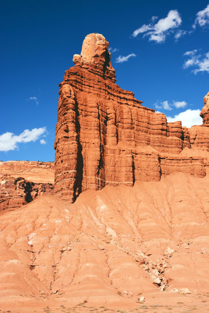
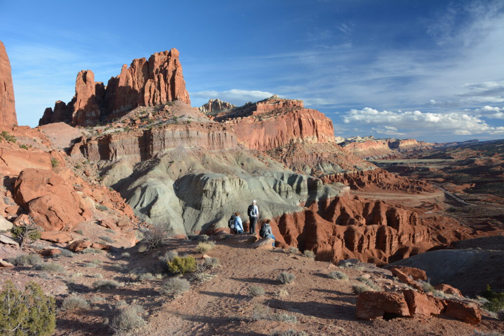
When you arrive at Capitol Reef, this might be the rock formation that sticks out to you first.
Most of the hikes in Capitol Reef are out-and-back trails, so this loop is a nice alternative. Hiking in a counterclockwise direction is best for your knees. After this grueling start, the trail is relatively flat.
Along the trail, views will open up to Fruita, the Waterpocket Fold, and lovely geologic formations. Of course, you’ll also have glorious views of Chimney Rock.
If the 3.6-mile loop is too much, you can hike 1 mile to the Chimney Rock Overlook and then return the way you came for a more moderate 2-mile hike.
Should you choose not to hike, the viewpoint from the highway is pretty spectacular as well.
Old Wagon Trail Loop
Difficulty: Strenuous
Distance: 3.8 mi (6.1 km) round-trip
Elevation Change: 1,080 ft (329 m)
Estimated Time to Complete: 2 to 3 hours
Pets: No
Access: Paved road, all vehicles okay
Trailhead: Old Wagon Trail on Scenic Drive (6.5 miles down)
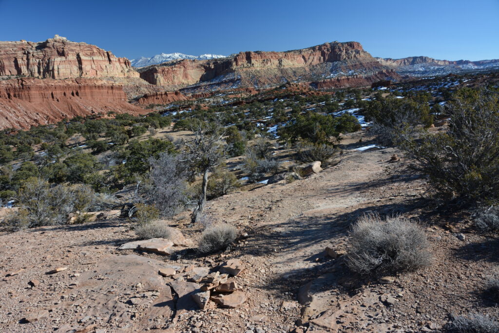
A hike through the forest in Capitol Reef National Park. Yes, you read that right.
As the name suggests, this trail follows a historic wagon road. The views of the Waterpocket Fold are stunning along the way.
If you’re interested in history, we’d recommend this hike. Otherwise, hikers would probably prefer the scenery at some of the other strenuous treks on this list.
We’d recommend hiking the loop clockwise.
Navajo Knobs
Difficulty: Strenuous
Distance: 4.7 mi (7.6 km) one-way
Elevation Change: 1,620 ft (494 m)
Estimated Time to Complete: 4 to 7 hours
Pets: No
Access: Paved road, all vehicles okay
Trailhead: Hickman Bridge Trailhead on State Route 24
Did we save the best for last? Perhaps.
If you’re looking for a longer hike on the Rim Overlook Trail, the Navajo Knobs is a convenient extension. It is one of the most difficult hikes in Capitol Reef, so be prepared. You’ll want trekking poles for this steep hike.
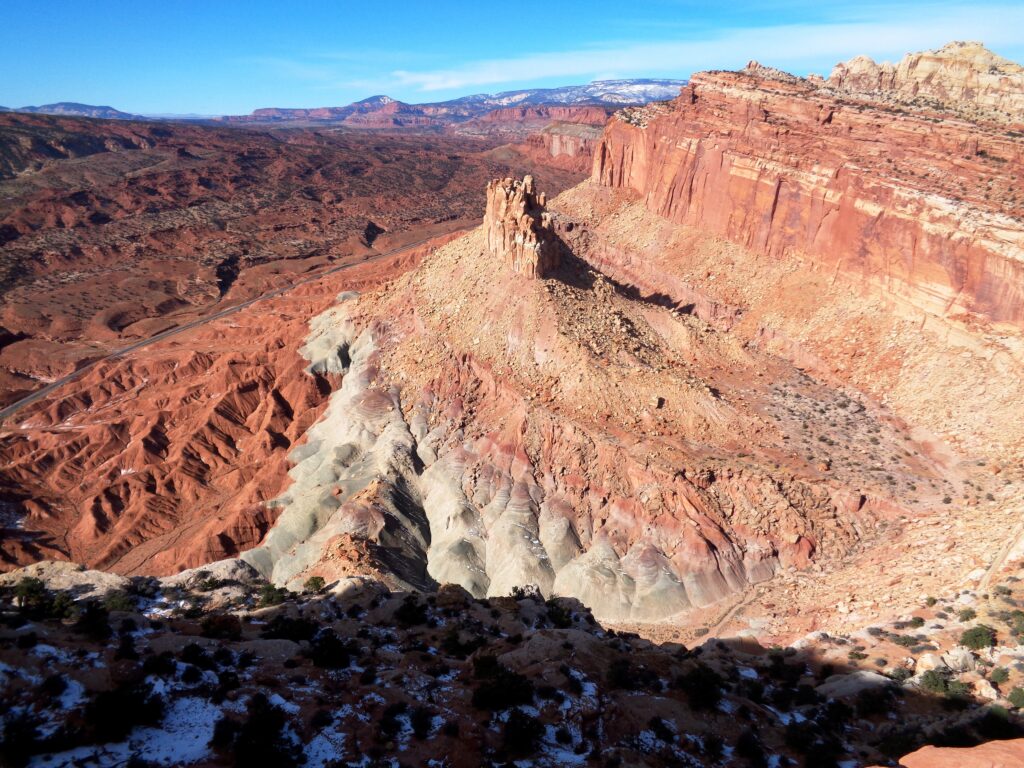
First, follow the Rim Overlook Trail. Continue beyond its end for another 2.5 miles. You’ll see amazing views of the Waterpocket Fold and Castle Rock as you hike. Once you pass Castle Rock, the trail is entirely uphill.
The Navajo Knobs are aptly named rock formations that are distinctly knob-shaped. The end of the trail sits at the top of these knobs. The climb is worth it for epic views of the valley below. Honestly, it might be the best viewpoint in the entire park.
This is the best hike in Capitol Reef National Park for 360-degree panoramic vistas. Since it is long and difficult, make sure to check the weather and don’t exceed your own abilities.
Since this small parking area is the starting point for many Capitol Reef trails, arrive early to secure a space.
Other Things to Do at Capitol Reef National Park
While hiking is a major highlight for many visitors, it’s not the only thing to do here! There is plenty to see if you don’t fancy yourself a hiker or if you have mobility challenges.
Panorama Point

Hiking in Capitol Reef can lead to some impressive views, but the vistas you can drive to aren’t too shabby. Panorama Point is one of the most popular. It’s on State Route 24 as you drive into the park. Even if you plan on hiking during your visit, this viewpoint is worth the photo stop.
Scenic Drive
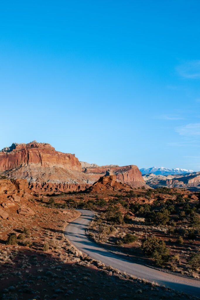
To take in some of the best scenery in Capitol Reef, take a tour of the 8-mile Scenic Drive. This paved route is an excellent alternative for anyone who doesn’t want to venture onto the unpaved roads in the park. Though the drive is short, with so many scenic viewpoints you’ll want to allow at least 2 hours to complete it.
Capitol Reef Petroglyph Panels
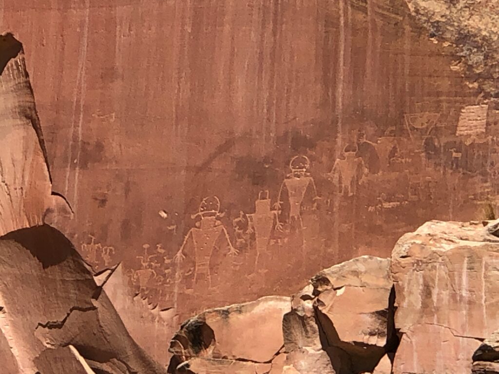
People of the Fremont Archaeological Culture created petroglyph panels dating back to 600 to 1300 C.E. Images include humans and bighorn sheep. The panels are located on the side of State Route 24 about 1 mile east of the visitor center. There’s a short walk to see them, but nothing we would consider a hike.
Fruita Schoolhouse
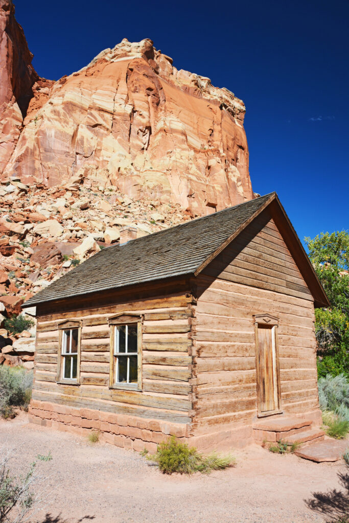
It can be particularly interesting to learn about history through the lens of children. The exhibits inside the Fruita Schoolhouse aim to tell stories from the perspective of the students in this one-room cabin. Items around the room resemble what it would have looked like in the 1930s. Teachers play a big role as well. In fact, the first schoolteacher was just 12 years old! The schoolhouse was placed on the National Register of Historic Places in 1964.
Fruita Orchards
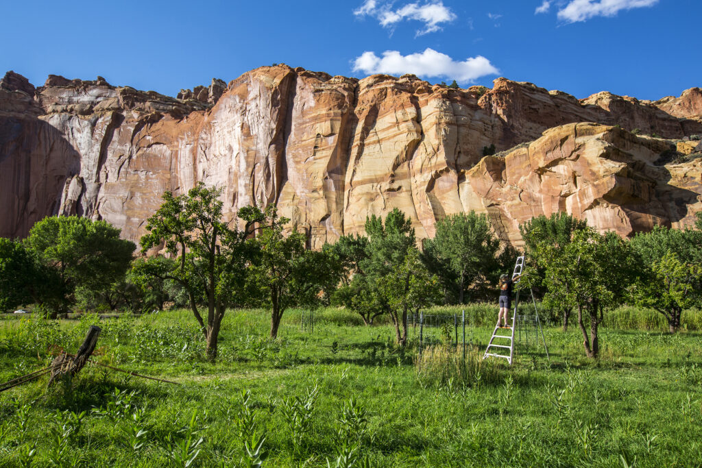
Did you know that Capitol Reef National Park is home to one of the largest orchards in the National Park Service? There are over 2,000 trees that fruit apples, peaches, pears, apricots, cherries, and plums. Visitors here from March to May may be lucky enough to see the trees flowering, and from June to October you can harvest fruit to take with you (for a small fee).
Gifford House

This historic house and museum is open from spring to fall. Visit to learn about pioneer history and homesteading. If you can, arrive early to get a slice of freshly baked pie with fruit from the orchards. The store inside also sells locally made items and more.
Where to Stay Near Capitol Reef National Park
There are many lodges and hotels near Capitol Reef National Park in the nearest town, Torrey. Those highest recommended are the Red Sands Hotel, Capitol Reef Resort, Noor Hotel, Broken Spur, and Rim Rock Inn.
There are also three Capitol Reef campgrounds, one frontcountry and two primitive.

What to Pack for Your Capitol Reef Hiking Trip
- Navigation systems: map, compass, and/or GPS
- Sun protection: sunscreen and/or ballcap
- Insulating layers: synthetic or down jacket, rain jacket, hat, gloves, and leggings
- Illumination (flashlight or headlamp)
- First-aid kit
- Something to light a fire: lighter, waterproof matches, and/or fire starter
- Repair kits and tools: pocket knife, duct tape, screwdriver, and/or scissors
- Emergency shelter: tent, bivy, tarp, and/or space blanket
- Nutrition: food for both meals and snacks
- Hydration: water bottle, water treatment (LifeStraw or SteriPen), and water
Pin the Best Hikes in Capitol Reef National Park

Did you just add 20 Capitol Reef hikes to your bucket list? We hope you’ll carve out some time to visit and explore this park. It’s just as cool (if not cooler??) than its other Utah neighbors.
Don’t forget to check out other posts from Utah before you go!
- Ultimate Guide to an Epic One Day in Arches National Park Itinerary
- 20 Fun Things to Do in Bryce Canyon National Park
- The 15 Best Hikes in Canyonlands National Park: A Comprehensive Guide
- Zion National Park Camping Guide: Everything You Should Know About Camping in Zion
What’s your favorite hike in Capitol Reef? Please share it with us in the comments!