Death Valley National Park is one of the hottest and driest places in North America. It’s also home to some of the most spectacular scenery you’ll ever see. If you’re planning a trip, this Death Valley itinerary will show you the best of the park in two days.
This Death Valley itinerary includes all the must-see attractions and some ideas for more things to do if you have extra time. This spectacular park is the largest in the continental United States and has plenty of amazing things to see and do. Are you ready to explore?
This post may contain affiliate links. If you make a purchase, I may earn a small commission at no additional cost to you. For more information, view my privacy policy.
Table of Contents
How to Get to Death Valley

Death Valley is a popular destination. To get here, you can fly into Las Vegas and rent a car to drive the two hours to Death Valley National Park.
Other nearby airports include Los Angeles and San Diego.
It’s also possible to take Amtrak or Greyhound from Los Angeles or San Francisco.
When to Visit Death Valley
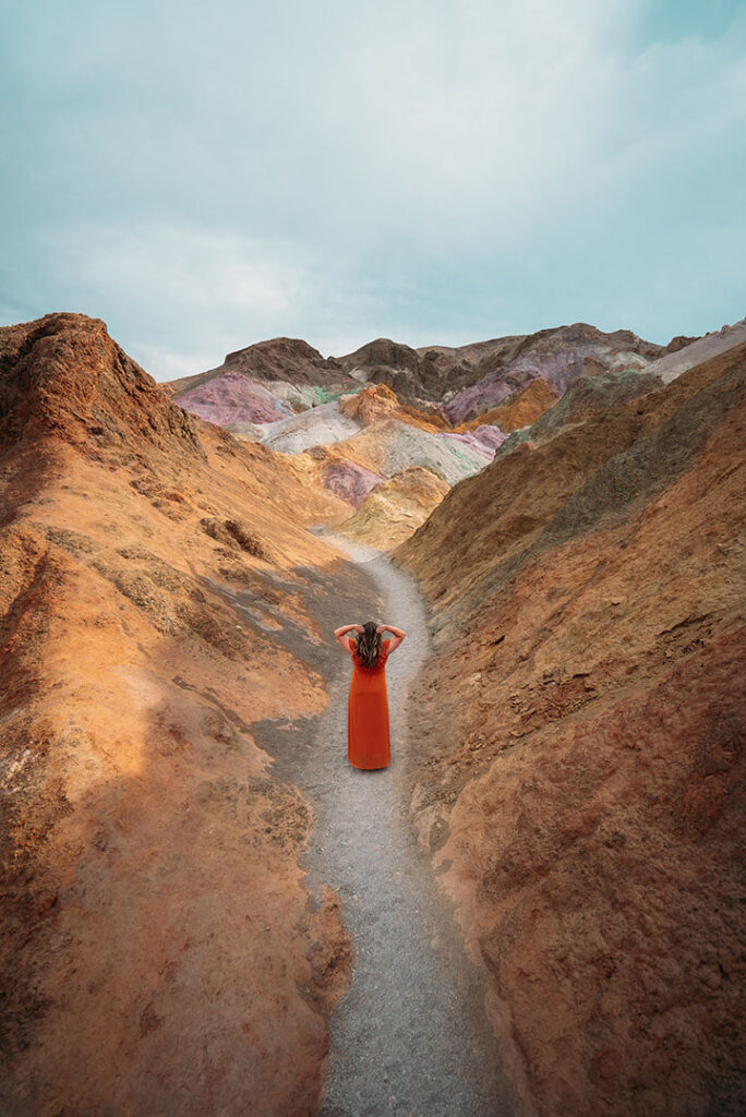
Death Valley is open year-round, but the best times to visit are in spring, fall, and winter when daytime temperatures are cooler. In the summer, it’s hot! Often over 100°F (38°C) at low elevations. At one time, Death Valley National Park recorded the hottest temperature on Earth! In 1913, a temperature of 134°F was recorded at Furnace Creek.
Short answer: I would plan to visit between November and March.
Things to Know Before You Visit Death Valley

Heat: Did I mention Death Valley is hot? It’s important to prepare by bringing loose layers to wear and drinking plenty of water! If you plan on hiking, do so early in the day to avoid the hottest temperatures.
Entrance Fee: There is a fee to enter Death Valley National Park. This is valid for 7 days. The actual costs depends on how you’re traveling. The entrance fee is $30/vehicle, $25/motorcycle, or $15/person (on foot or bicycle). If you’re visiting other national parks in California or Nevada, consider purchasing a National Parks Pass to save money!
Elevation: The elevation in Death Valley ranges from -282 feet below sea level to 11,043 feet on Telescope Peak. Prepare to acclimate if you plan on hiking in the higher elevations.
Cell Reception: Don’t expect to have any cell phone service or internet during your visit. Download any maps and information ahead of time using the NPS App.
Food: Due to Death Valley’s remote location, there are not many options for food. Some favorites include Badwater Saloon, Last Kind Words Saloon, and Timbisha Tacos. Expect to pay pretty high prices for mediocre food.
Gas: Likewise, due to its remote location gas prices can be exorbitant. I highly recommend filling up before you enter the park.
Maps: If you can’t download maps on your phone, or you’d prefer to save your battery for pictures, bring a paper map of Death Valley with you.
Where to Stay Near Death Valley

There are several lodges within Death Valley National Park. Due to their amazing location and proximity to popular things to do in Death Valley, they are a bit pricey.
The Ranch and The Inn are two of the most expensive options in the park, but also offer very nice accommodations and amenities. There are also restaurants inside each offer discounts to anyone staying in the hotels. Other options in the park include the Panamint Springs Resort and Stovepipe Wells Village.

There are also several towns and cities near Death Valley that offer accommodations.
Beatty, NV offers the Death Valley Inn and RV Park, Exchange Club Motel, Atomic Inn, and El Portal Motel.
Pahrump, NV is a larger town with familiar chain hotels, such as the Best Western, in addition to smaller operations like the K7 Bed and Breakfast. RVers may be interested in the Pahrump RV Park.
Death Valley Junction is home to one of the more unique hotels near the park. The Amargosa Opera House is a historic theatre transformed into a fun hotel.
In Shoshone, we stayed at the Shoshone Inn for our visit. Recently renovated with the kindest owner, this stay was worth every penny. Like Pahrump, Shoshone also offers an RV Park.
Lone Pine is one of the largest towns near Death Valley. It also serves as the access point for Mount Whitney hikers or those interested in seeing the scenic Alabama Hills. Hotels in Lone Pine include the Quality Inn, Mount Whitney Motel, a Hostel, and the historic Dow Hotel.
You can also go camping in Death Valley at one of the nine campgrounds in the park. I recommend Furnace Creek or Stovepipe Wells, as they are more centrally located.

Death Valley National Park Phone Case

Death Valley National Park Pennant

Fodor’s Guide to the 63 National Parks

Women’s National Parks Checklist T-Shirt

Women’s National Parks Checklist T-Shirt

Map of National Parks T-Shirt

Death Valley National Park Sticker

Death Valley National Park Pin

Death Valley National Park Patch

63 National Parks Water Bottle

Death Valley National Park Sticker

Death Valley Sticker

California National Parks Face Mask

Death Valley National Park Map
One Day in Death Valley
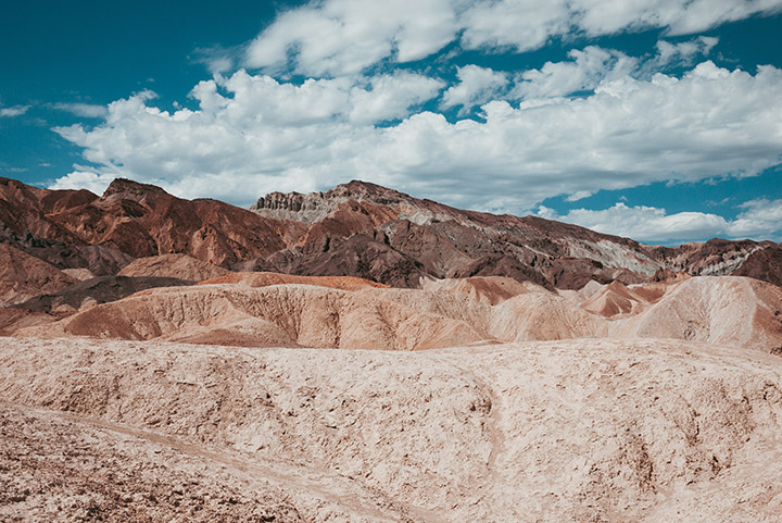
Here are some suggestions for the first day of your Death Valley itinerary. This could also be used if you only have one day in the park, though you may want to mix and match things from each day. If you can, I highly recommend allowing two days in Death Valley. The park is huge and its attractions are spread out. It’ll be worth the time, I promise.
Dante’s View

If arriving from Las Vegas, you’ll likely take Highway 190 into Death Valley National Park. A winding road will bring you to your first stop, Dante’s View. This viewpoint provides a stunning overlook of the landscape you’ll explore over the next two days in Death Valley.
Dante’s View is the perfect place to begin or end your Death Valley itinerary. It provides an amazing overlook that includes the chance to view the highest point in the continental United States (Mount Whitney over in Sequoia National Park) and Badwater Basin, the lowest point in North America.
Zabriskie Point
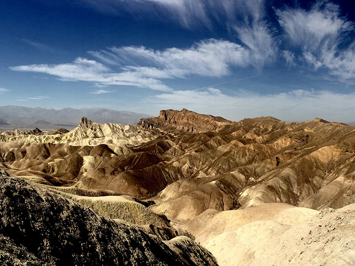
Without question, Zabriskie Point is a must-see. Landscapes like the one at Zabriskie Point are why you made the trip to Death Valley.
On your first day, consider waking up early for sunrise at Zabriskie Point. This is mere minutes from some of the best lodging and campgrounds in Death Valley, so you won’t need to wake up as early as you may think.
The sun shines on the formations in the morning, making them even more vibrant.
If you’re not an early riser, don’t worry. The rocks and views are incredible any time of day.
Go For a Hike
Next, I recommend hiking before the heat sets in for the day. Near Zabriskie Point, you’ll find some of the best hikes in Death Valley.

Starting from Zabriskie Point, you could easily hike through Golden Canyon. This is a moderately strenuous hike that rewards you with amazing views of ancient rock formations.
It’s 2.5 miles from Zabriskie Point to the Golden Canyon parking area, one-way. You can make this an out-and-back hike or turn it into a loop by following Gower Gulch.
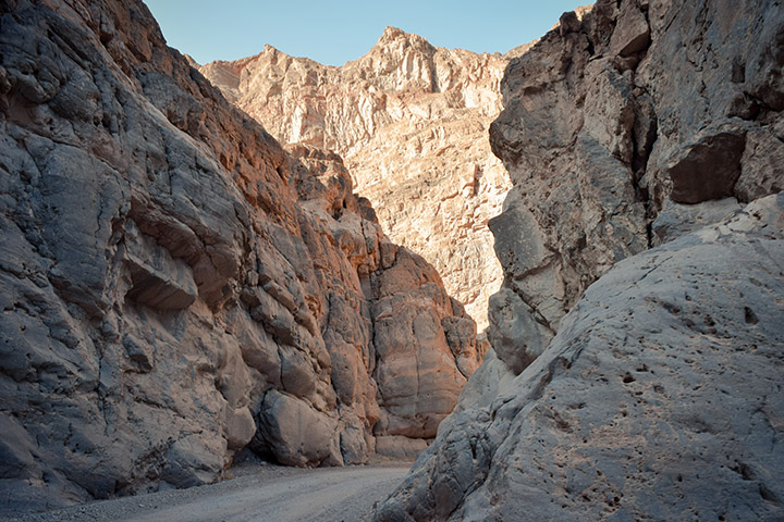
Another hike in the area is Desolation Canyon. Are you noticing a trend with the names in Death Valley?
Desolation Canyon is a moderate 3.6-mile roundtrip hike. Getting to the parking area requires driving on a well-maintained unpaved road. While I still recommend hiking early to beat the heat, there are a couple of shade spots in this canyon. If you’re a Star Wars fan, you may recognize some of this canyon!
Furnace Creek Visitor Center

Depending on the hike you choose, it may make more sense to stop here before setting out on the trail.
At the visitor center, gather information from park rangers on the best way to spend your Death Valley itinerary. Rangers will have updated conditions on trails you may be interested in as well as unpaved roads you may need to drive to some attractions.
You can also stamp your passport book, buy souvenirs, grab some snacks, and refill your water bottle here.
Devils Golf Course

One of the most popular attractions in Death Valley is a stunning landscape called Devil’s Golf Course. Take the unpaved road to the parking area to view these unusual formations.
Badwater Basin

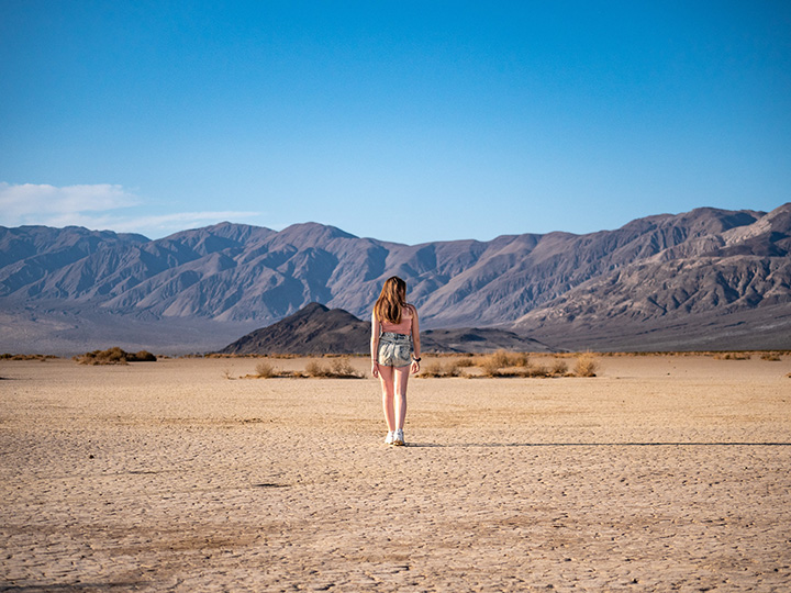
Next, visit the lowest point in North America at Badwater Basin at -282 feet. You may walk out on salt flats for as long as you’d like.
Don’t forget to take a picture with the sign!
Please don’t carve your name into the salt; leave the landscape untouched for other visitors to enjoy.
Natural Bridge

If you want to do another short hike, Natural Bridge isn’t far from here. Remember to bring lots of water and sun protection if you choose to add this to your Death Valley itinerary. This 1-mile hike will lead to a natural bridge reminiscent of those you might find in Arches National Park.
To reach the parking area, you’ll need to drive down an unpaved road. The road and parking area are suitable for larger vehicles and RVs.
It’s not the most spectacular hike, so if you are short on time or the heat is getting to you, I would skip this.
Artists Drive
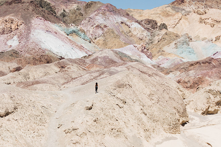
On your way back north, take a short detour via Artists Drive. This one-way road takes you through some of the most vibrantly colored rocks in Death Valley.
Since it’s one way, it makes more sense to drive it on the way back to limit backtracking. Make sure you enter from the correct direction!
Harmony Borax Works Interpretive Trail

If you’re up for one more stroll, stop by the Harmony Borax Works. This short interpretive trail will introduce you to some of the mining that used to take place in Death Valley.
The paved 1/4-mile loop is wheelchair- and stroller-friendly. Along the trail, you’ll learn about Borax mining, life in Harmony, and the 20-mule team.
Stargazing

After a full day exploring Death Valley, I encourage you to see the park after dark. Death Valley is one of the darkest places in the continental United States. Stargazing in Death Valley will make you feel like you’re on another planet!
You can join a park ranger for a stargazing program or stargaze on your own. If you’re interested in ranger programs, check at the Furnace Creek Visitor Center or online for a schedule.
To stargaze on your own, try to find a spot away from lights and the road. It’s also best to have an unobstructed view of the sky. During my last visit to Death Valley, a friend and I stargazed from the Harmony Borax Works parking area. Though the headlights nearby were disruptive, we were still treated to a beautiful night.
Death Valley Itinerary: Day Two

On the second day of your Death Valley itinerary, there will be a bit more driving than the first day.
Once again, we’ll start our day hiking to avoid the heat later in the afternoon.
After visiting the Sand Dunes and Mosaic Canyon, there are two routes you could take to complete your Death Valley itinerary. Both are detailed below. Alternatively, you could spend three days in Death Valley to fit it all in!
Mesquite Flat Sand Dunes
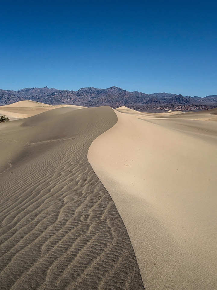
Beat the crowds and arrive here as early as you can. You can hike as far or as little of the dunes as you like. The farther out you go, the more seclusion you’ll earn.
Make sure you know how to find your way back to the parking area. It’s easy to get lost in fields of sand.
If you prefer to stay close to the parking area, the hike to the highest dune is 1 mile each way. There is no marked trail, but it’s relatively easy to find your way.
This is easily one of the most photographic locations in the park and is essential for anyone’s Death Valley itinerary.
Mosaic Canyon

Next, take another scenic hike through a colorful canyon. If you only want to choose one canyon hike, Mosaic Canyon was my personal favorite.
At times, this hike was very narrow allowing you an up-close look at the beautiful layers of colors in the rock walls. In places, the walls look like marble.
The entire trail is 4 miles roundtrip, but don’t feel as if you are required to hike the full trail. Some of the best narrow canyon areas are within the first 1/2-mile.
Getting here requires driving a well-maintained unpaved road that is usually passable in a sedan.
Route 1: East to Panamint Springs

If your Southern California itinerary is taking you east, you might find this route is the most convenient. There are several things to do in Death Valley along the way.
Eureka Mine

After passing through the small developed area of Emigrant, take Emigrant Canyon Road toward Eureka Mine.
Feel free to stop here for photos, but do not explore any abandoned mines. This is very unsafe!
Driving to Eureka Mine requires driving a short unpaved road.
Wildrose Charcoal Kilns

After visiting the mines, continue south toward Nemo Canyon and take a right on Wildrose Canyon Road. This will take you to the mysterious-looking charcoal kilns.
Parts of this drive require unpaved roads. If you continue on Wildrose Canyon Road to Panamint Valley Road, your vehicle cannot exceed 25 feet in length. This is due to the narrow and winding nature of this portion of the road.
Father Crowley Vista Point

The last stop on your Death Valley itinerary is Father Crowley Vista Point. This point is famous for a few things: Star Wars films and active aircraft.
If you visit at the right time, you may see practice military flights take place!
Route 2: North Toward Scotty’s Castle

If you’re up for more driving, you can also continue north. This route provides access to Scotty’s Castle, Ubehebe Crater, and the Race Track.
Scotty’s Castle

One of the top attractions in Death Valley is Scotty’s Castle. It’s located at the north end of Death Valley, about two hours from Furnace Creek.
This beautiful Moorish-style castle was built by Chicago millionaire Walter Scott between 1924 and 1933 for entertaining guests during his frequent visits to Death Valley. He died before he could finish it, but you can still tour the home to see his lavish tastes.
Unfortunately, Scotty’s Castle has been closed for years due to extensive flood damage. Check the official website for updates on its reopening.
Ubehebe Crater

Just north of Scotty’s Castle is Ubehebe Crater. A short hike from the parking lot will take you to a beautiful crater formed by volcanic activity over 2,000 years ago.
The best views are on an easy 1/2-mile roundtrip trail that starts near the end of the road as it passes between two large boulders. You can also hike around the crater rim or down into the crater itself.
The Racetrack
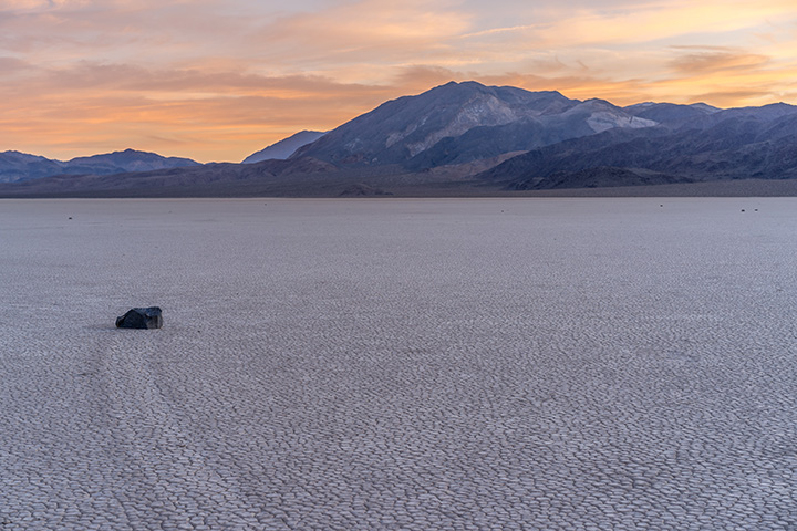
After leaving Scotty’s Castle, continue north on Scotty’s Castle Road to the Racetrack. This is a great Death Valley attraction for anyone who enjoys driving bumpy dirt roads.
The road ends at an observation point where you can get out and walk around this area of moving rocks. There were several theories as to how these rocks move, but a recent study proved they are moved by the wind, leaving tracks behind as they slowly make their way across the valley floor.
Driving here will take most of the day (allow at least 2 hours each way) and requires a high-clearance 4WD vehicle. I would also recommend bringing multiple spare tires along. I cannot emphasize enough how rough this road is!
More Attractions in Death Valley

If you have more time, consider adding some of these sites to your Death Valley itinerary.
Hike Telescope Peak

At over 11,000 feet above sea level, Telescope Peak offers a great view for hikers willing to take on its strenuous trail. This is the highest point in Death Valley National Park. That means amazing views after a full day of hiking.
Darwin Falls
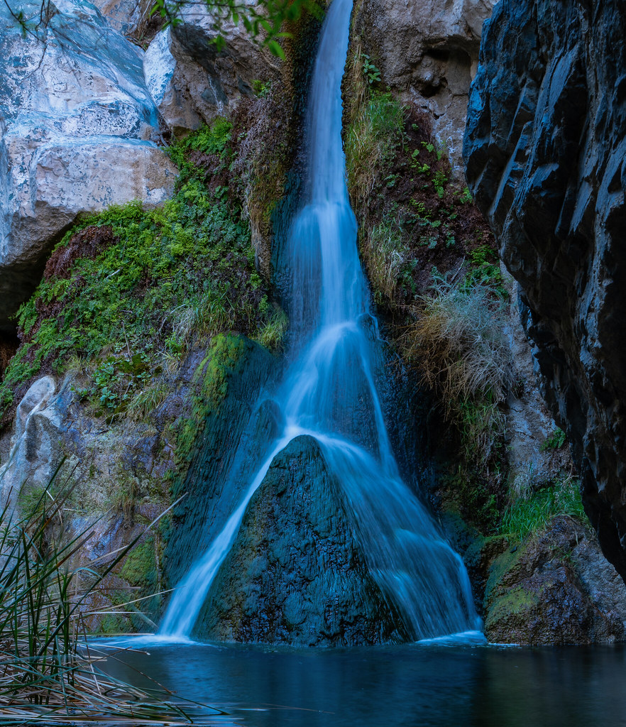
This hike is only a one-mile roundtrip walk from the parking lot and takes about an hour to complete. Make sure your shoes are waterproof!
The trail is unmarked, so pay close attention to the sign at the parking area.
No swimming! This resource is fragile and needs to remain protected.
Prepare to drive an unpaved road to reach the parking area. This is not recommended for large vehicles or RVs. It’s typically passable in a sedan, but much easier in a high-clearance vehicle.
Twenty-Mule Team Canyon

Twenty-Mule Team Canyon is a great stop for anyone interested in geology. It’s also ideal for those who have a bit more time to explore one of Death Valley’s best-kept secrets.
The unpaved drive is passable for most vehicles. It is one-way, so make sure you enter from the correct direction.
There are a few unmarked pullouts along the way, each with short unnamed trails so you can explore more rock formations.
Titus Canyon Road

This is a spectacular drive through an extremely narrow canyon at the northern end of Death Valley. You’ll pass it on your way to Scotty’s Castle and Ubehebe Crater if you choose to travel that way.
It’s a beautiful view that will take most cars about half a day from Furnace Creek but is not recommended for RVs.
Eureka Dunes
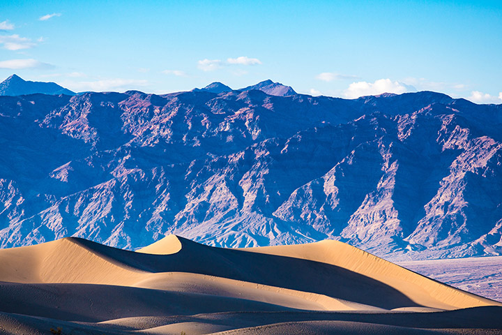
This Death Valley attraction is a must-see if you have an hour to spare.
The Eureka Valley Sand Dunes are beautiful and vast, but they only exist because of the lack of vegetation in this area. The dunes constantly shift as the wind blows them around. To see the most interesting shapes, go just before sunset when the light is low.
Elevation at the parking area is around 2,700 feet, but you will feel like you are on top of the world when looking down from up here!
These dunes are a great option for a more isolated and quiet experience compared to the popular and easily accessible Mesquite Flats.
Pin the Expert’s 2-Day Death Valley Itinerary

This park has so much to offer, you should plan at least two days in Death Valley. There are many other Death Valley attractions that show up on travel bucket lists, but these are the ones I recommend for a great Death Valley itinerary!